ship logo General Reference Guides Census Records Military Records African-American Records Other States New Titles E-Books
          Home             Reference                 Census Records       Military           African-American         Other States         New Titles           E-BOOKS     FREE SHIPPING IN USA

Iberian Publishing Company's On-Line Catalog:
Tazewell County Virginia


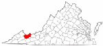
Map of Va: Tazewell CountyTazewell County was formed in 1800 from portions of Russell and Wythe counties. The new county was named for Henry Tazewell, United States senator from Virginia from 1794 until his death in 1799. Russell gave an additional parcel to Tazewell in 1807. Logan County, formed in 1824, took its territory from Tazewell. In 1835 a portion of Russell County was added to Tazewell, and in 1836 a single farm was transferred from Tazewell to Giles jurisdiction. The following year, in 1837 Mercer County was created from portions of Tazewell and Giles counties. Buchanan and McDowell counties took additional parts of Tazewell in 1858. After that Tazewell's boundaries reached their current position.

For a better understanding of county boundary changes, see our new section Virginia in Maps
Iberian also has hundreds of titles in e book (PDF) format!! Click here for a complete online catalog of available titles

TAZEWELL COUNTY, VA 1810 SUBSTITUTE CENSUS [Abstracts from the 1810 Personal Property Tax List] by John Vogt, 2011, 5 1/2"x8 1/2" format, viii, 6 pages, map.
        Tazewell is one of eighteen Virginia counties for which the 1810 census is lost. In August, 1814 British troops occupied Washington, DC and public buildings were put to the torch. In the destruction that followed, numerous early records of the government were lost, including all of Virginia's 1790 and 1800 census reports, as well as eighteen county lists for the state's most recent [1810] federal census. Although two "fair copies" of each county's census had been left in the counties for public display, these were ephemeral lists and not preserved, and by 1814 they too had been mislaid, lost, or destroyed. Hence, the closest document available we have to reconstruct a partial image of the missing county lists is the personal property tax list.
       According to research notes by Minor T. Weisiger, Library of Virginia archivist: "Information recorded in Virginia personal property tax records changed gradually from 1782 to 1865. The early laws required the tax commissioner in each district to record in "a fair alphabetical list" the names of the person chargeable with the tax, the names of white male tithables over the age of twenty-one, the number of white male tithables between ages sixteen and twenty-one, the number of slaves both above and below age sixteen, various types of animals such as horses and cattle, carriage wheels, ordinary licenses, and even billiard tables. Free Negroes are listed by name and often denoted in the list as "free" or "FN."
       The present abstract of Tazewell's 1810 personal property tax list is NOT a transcript of the entire document; rather, it is a summary of three items important in delineating the 1810 "substitute" census for this county, i.e., number of male tithables 16 and older, number of slaves twelve years and older, and the number of horses. The original form of the census was in alphabetic order by date and letter [see example on page vi below]. The substitute list presented here is in absolute alphabetic order for easy reference.

In the current volume, the data is recorded thus:
        Coleman, Cain                           1          -          -
        Coleman, Obadiah & his sons,
                James, John, &
                Anderson                           4          6        9
        Coleman, William &
                Coleman, Whitehead        2        21        25

        Column one represents the tithable males (16 and over) in the household; column 2 is the number of slaves over 12; and the final column is the number of horses, mares or mules.
        For genealogical researchers in this 1810 period, personal property tax records may provide additional important information. Oftentimes, juniors and seniors are listed adjacent to one another and recorded on the same day. When a taxpayer is noted as "exempt", it can be a clue to someone holding a particular position in government or being elderly, infirm, or for some other reason no longer required to pay the tithable tax. Women, both black and white, appear occasionally as heads of households when they own property in their own right or as the widow of a property owner.
        Another valuable source for filling in information about an ancestor is the land tax record, and especially the one for 1815. In that year, the enumerators began to add the location of the property in relation to the county court house. Roger Ward has abstracted all of the 1815 land tax records, and they are available from this publisher at www.iberian.com.
        The 1810 substitute census list for Tazewell County contains 453 households, 537 tithables, both white and free black, and 173 slaves over the age of twelve, and 1,751 horses.

SURNAMES included in the 1810 personal property list are:
          Adams; Adkins; Allen; Alsup; Arnal; Aronhart; Asbury; Ashbury; Ashby;

          Bailey; Balden; Baley; Ballew; Bandy; Barker; Barnet; Barns; Been; Belcher; Belsha; Belsher; Beverly; Bevers; Biggs; Blankenship; Bolen; Bostick; Boswell.; Bowen; Brooks; Brown; Bruster; Burgman; Burriss;

          Cambel; Carter; Cartmill; Cassady; Day; Cecil; Christian; Chriswell; Clapole; Clark; Coleman; Conley; Corder; Correl; Crage; Crawford; Crockett; Cumpton;

          Daly; Deskin; Davidson; Davis; Day; Deskins; Dills; Doake; Dolsbury; Dotson; Drake;

          Elsac;

          Fannon; Fletcher; Flummer; Fortner; Fox; Francisco;

          Garrison; George; Gibson; Gillespie; Godfrey; Godfry; Golsby; Gooden; Goss; Green; Grenup; Griffith; Griffitts; Grudd;

          Hager; Haley; Hall; Hankins; Hanson; Harman; Harman; Harper; Harrison; Harriss; Hartwell; Havens; Hedrick; Helvy; Heninger; Hicks; Higginbotham; Higginbothum; Hinkle; Hortain; Husk;

          Jeffry; Jent; Johnston; Jones; Justice;

          Kidd; Kindle; Kindrick; King; Kirk; Kook;

          Laird; Lambert; Lasley; Lee; Lester; Likens; Lockhart; Lortain; Lusk; Luster;

          Marlow; Mars; Martain; Matney; Maxwell; McCurdy; McDowel; McGuire; Mclngtosh; McMillin; Meloney; Merman; Messersmith; Milum; Mitchel; Moor; Morgan; Murry;

          Neel; Newton; Nuckels;

          O'Danold; Oney; Ony; Owens;

          Patten; Peery; Perry; Pleasant; Power; Prater; Pruet; Pruett;

          Ratliff; Reignhart; Reyburn; Right; Robinson; Runnion;

          Sanders; Sawyers; Shannon; Shortridge; Simpson; Skaggs; Slater; Smith; Smythe; Steel; Stephenson; Stiltner; Stobauck; Stowers; Stump; Suiter; Suter; Swader;

          Taylor; Thompson; Thorn; Tifney; Todd; Tomblenson; Totten; Trent; Trout; Turner;

          Vandyke; Vincel; Vinsle;

          Waggoner; Walls; Ward; Webb; Weltch; Whit; White; Whitley; Williams; Wilson; Wilton; Witten; Workman; Wynne;

          Young;
Add to Cart

[TZPP] $4.00     (printed version)


The above title is also available as a digital e-book in PDF format:
Add to Cart

[ETZPP] $2.00     (electronic version)


SELECTED DEATH RECORDS OF SOUTHWEST VIRGINIANS WHO DIED IN MISSOURI (OR WERE RELATED TO THOSE WHO DIED IN MISSOURI (with additions from Iowa and Sullivan County/East Tennessee) Researched by Thomas Jack Hockett; Abstracted & compiled by by Donald W. Helton. iv,220pp., every-name index (8.25" x 10.75" paperback). These deaths are taken from a variety of sources and methods employed, including "hunt and seek", census, on-line sources at Rootsweb, Ancestry, IGI, Family Genealogy Forums, censuses, etc. and the very valuable Missouri Death Certificates 1912-1958 which are generously available online. These deaths of mid and extreme SW VA people in MO during the subject time likely represent only a fraction of the deaths which could be ferreted out with difficulty employing 2-4 sources (in conjunction) in conjunction. The work represents considerable labor (not to mention eye-strain) and it is hoped it will bolster further the efforts to document the migration of SW VA persons".

During the process of abstracting and compiling the death records listed herein, instances of conflict occurred between the certificate and additional information found on-line. The information is entered as found. Any such conflicts are left to the discretion of the reader to reconcile.
Table of contents
Missouri Deaths from
      Washington County       1
      Wythe Co., Va      43
      Russell Co., Va      56
      Grayson/Carroll Cos., VA       80
      Smyth Co., Va      85
      Tazewell Co., Va      101
      Lee Co., Va      118
      Scott Co., Va      138
      Dickenson Co., Va      151
      Buchanan Co., Va      154
      Miscellaneous Deaths from southwest Va.      181
      Iowa Deaths from Southwest Virginia      193
      Alphabetical Index      202
To view a digital copy of the index to this book, visit Index-Sdmo
(Use your back arrow to return to Iberian's catalog)

Add to Cart

[SDMO] $31.95


The above title is also available as a digital e-book in PDF format:
Add to Cart

[ESDMO] $20.00     (electronic version)


Tazewell Co. 1815 Directory of Landowners by Roger G. Ward. 2005. 14 pages, map, 5 1/2X8 1/2.
For a full description of the 1815 LAND DIRECTORY Records and a listing of available counties, see combined volume below
Add to Cart

[Vd99] $6.00


The above title is also available as a digital e-book in PDF format:
Add to Cart

[EVd99] $4.50     (electronic version)


1815 DIRECTORY OF VIRGINIA LANDOWNERS & GAZETTEER, vol. 5 Southwestern Region (Includes the counties of Augusta, Bath, Botetourt, Giles, Grayson, Greenbrier, Lee, Monroe, Montgomery, Pendleton, Rockbridge, Russell, Scott, Tazewell, Washington, and Wythe ) abstracted by Roger G. Ward. 1997, vi, 240 pages, indices, maps.
In 1782 the General Assembly of Virginia enacted new tax laws which created within each county an enumeration of land and certain personal property. These early land tax laws required a tax commissioner in each district of a county to record a list of the names of persons owning land or town lots, the quantity of land owned and its value, and the amount of tax owed. By 1813, a brief geographic description (usually citing an adjacent stream, road, or other landmark) was required; in 1814, the distance and direction from the courthouse for each parcel was also added to the tax rolls.
The present work is an alphabetical listing of all 1815 landowners found in each county, as well as the accompanying description of the location of the said property. We have not included the number of acres, taxes assessed, or any transactions between landowners which may have been noted on the tax rolls; also, in many cases the geographic location was provided as "adjacent to John Smith", etc. and, while useful many times to a genealogist, was considered to be beyond the objectives of this project. The reader is encouraged to consider the information here-in as an "outline" of early landowners in Virginia rather than a "text" due to the year-to-year variation in information provided to the clerk (or recorded by the clerk), omissions, lack of "identifiers" to determine if "same name" was also "same person" within a district or across districts, marginal quality/clarity (in a few cases) of the microfilm copy, and, not least, errors on the part of either the original clerks or the current author while transcribing.
Some of the approaches to utilizing the 1815 landowner information include:
  1. observe distinct clusters of the same surname within a county in order to clarify the common surnames such as "Smith", "Anderson", etc;
  2. identify non-resident landowners and their county (or state) of residence (these people often being former residents of the current county);
  3. determine neighbors with different surnames (often being relatives);
  4. use the 1815 information as a "bridge" from the 18th and 19th century deed/will books to the 17th and 18th century land grants/patents in the county;
  5. evaluate the 1810 to 1840 census information which generally grouped neighbors;
  6. substitute this information for missing deed/will books in the "burned" counties; and, clarify/enhance vague deed/will information in the counties with more complete records.
FORMAT OF PRESENTATION: Each entry is listed as: Surname, name, personal identifiers (if any); location/place-name of land; miles/direction from the 1815 courthouse. If multiple owners are listed for a property, the listing is duplicated under each of the owner's surnames (i.e "Smith and Brown" is also listed as "Brown, --see Smith"); when multiple owners share a common surname, the property is only listed once. When a landowner had land at more than one location/place-name, the miles/direction listing for each parcel is in the same sequence as the location listing (i.e. James RV, Slate CK; 12N, 5SW.). In the few cases where a landowner had "many" parcels, the miles/direction notation is attached to the location listing (i.e. Sandy RV- 5NE, Willow CK-7S, etc.)

Add to Cart

[Vdl5] $32.00    (paper version)


The above title is also available as a digital e-book in PDF format:
Add to Cart

[EVDL-5] $20.00     (electronic version)


For records pertaining to Tazewell COUNTY, VIRGINIA see:

Please see our HELP PAGE for mail-order instructions, wholesaler policies and other contact information.


|| Virginia/W.Va. || General Reference || Military Records ||
|| Other States || E-Books || New Titles
|| Home Page || E-Books ||

Copyright 2026 Iberian Publishing Company