ship logo General Reference Guides Census Records Military Records African-American Records Other States New Titles E-Books
          Home             Reference                 Census Records       Military           African-American         Other States         New Titles           E-BOOKS     FREE SHIPPING IN USA

Iberian Publishing Company's On-Line Catalog:
James City County Virginia


Map of Va: James City County James City County was one of the original eight shires established in Virginia in 1634. It was named for James I. As initially formed, James City County included the town of Jamestown and was bounded by York, Warwick, Isle of Wight, and Charles City counties. In 1652 James City's lands south of the James River were taken to form Surry County. In 1720 the portion of James City west of the Chickahominy River was transferred to Charles City. in 1766 a boundary settlement between James City and New Kent saw the upper end of James City going to New Kent and the lower end of New Kent reverting to James City. In 1769 the land north of the Duke of Gloucester Street in Williamsburg, where the James City Court House and the City of Williamsburg was to be built was given by York to James City County. Finally, in 1852 there was a boundary adjustment of the line in Williamsburg by which land was transferred again from York County to James City County. All of the early records of James City County were destroyed in the April, 1865 Richmond fire during the evacuation of the city.

For a better understanding of county boundary changes, see our new section Virginia in Maps
Iberian also has hundreds of titles in e book (PDF) format!! Click here for a complete online catalog of available titles
JAMES COUNTY, VA 1810 SUBSTITUTE CENSUS [Abstracts from the 1810 Personal Property Tax List] by John Vogt, 2011, 5 1/2"x8 1/2" format, viii, 6 pages, map.
        James City is one of eighteen Virginia counties for which the 1810 census is lost. In August, 1814 British troops occupied Washington, DC and public buildings were put to the torch. In the destruction that followed, numerous early records of the government were lost, including all of Virginia’s 1790 and 1800 census reports, as well as eighteen county lists for the state's most recent [1810] federal census. Although two “fair copies” of each county’s census had been left in the counties for public display, these were ephemeral lists and not preserved, and by 1814 they too had been mislaid, lost, or destroyed. Hence, the closest document available we have to reconstruct a partial image of the missing county lists is the personal property tax list.
       According to research notes by Minor T. Weisiger, Library of Virginia archivist: “Information recorded in Virginia personal property tax records changed gradually from 1782 to 1865. The early laws required the tax commissioner in each district to record in “a fair alphabetical list” the names of the person chargeable with the tax, the names of white male tithables over the age of twenty-one, the number of white male tithables between ages sixteen and twenty-one, the number of slaves both above and below age sixteen, various types of animals such as horses and cattle, carriage wheels, ordinary licenses, and even billiard tables. Free Negroes are listed by name and often denoted in the list as “free” or “FN.”
       The present abstract of James City's 1810 personal property tax list is NOT a transcript of the entire document; rather, it is a summary of three items important in delineating the 1810 "substitute" census for this county, i.e., number of male tithables 16 and older, number of slaves twelve years and older, and the number of horses. The original form of the census was in alphabetic order by date and letter. The substitute list presented here is in absolute alphabetic order for easy reference.

In the current volume, the data is recorded thus:
Beck, Robert                  1      -      2
Bellama, John                1      -      1
Booker, Richard E.        1      -      -
Bouldin, Green              2      6      5

        Column one represents the tithable males (16 and over) in the household; column 2 is the number of slaves over 12; and the final column is the number of horses, mares or mules.
        For genealogical researchers in this 1810 period, personal property tax records may provide additional important information. Oftentimes, juniors and seniors are listed adjacent to one another and recorded on the same day. When a taxpayer is noted as “exempt”, it can be a clue to someone holding a particular position in government or being elderly, infirm, or for some other reason no longer required to pay the tithable tax. Women, both black and white, appear occasionally as heads of households when they own property in their own right or as the widow of a property owner.
        Another valuable source for filling in information about an ancestor is the land tax record, and especially the one for 1815. In that year, the enumerators began to add the location of the property in relation to the county court house. Roger Ward has abstracted all of the 1815 land tax records, and they are available from this publisher at www.iberian.com.
        The 1810 substitute census list for James City County contains 337 households, 349 tithables, both white and free black, and 1,130 slaves over the age of twelve, and 593 horses.

SURNAMES included in the 1810 personal property list are:
        Allen; Ambler; Anderson; Ashlock; Austin;

        Bacon; Bailey; Banks; Barham; Barker; Barrett; Bartlett; Bassett; Bingley; Binns; Bolton; Bosher; Boswell; Bowden; Bracken; Breeding; Broadrib; Browne; Bryan; Burwell; Bush;

        Calivan; Cardwell; Casey; Cassady; Chadick; Chandler; Clark; Coke; Cole; Coleman; Cowan; Cowles; Crawdass; Crawley; Cumbo; Curie;

        Debriss; Delk; Dennis; Dixion; Dodd; Duncan; Dunsford; Dunston; Durfey;

        Earnest; Edmonds; Eggleston; Ellis; Evans;

        Farthing; Fenton; Fox; Francis; Freeman;

        Gadberry; Gaddy; Galt; Garrett; Geddy; George; Goddin; Goodall; Green; Griffin; Green; Guinn;

        Hall; Hankins; Harris; Harry; Harwood; Hatten; Hazlewood; Henderson; Henley; Hitchcock; Hixes; Hockaday; Holt; Horth; Hubard;

        Jackson; Armstrong; James; Jameson; Jennings; Johnson; Jones;

        Keen; Kirbey; Knewslip;

        Lee; Lester; Lightfoot; Lindsay; Litchford;

        Madison; Mahone; Marsh; Marston; Martin; McCandish; McCarty; McEndrae; McGregory; Miles; Miller; Minor; Moore; Morgan; Morris; Mutlaw;

        Nettles; Norris;

        Otey;

        Paradice; Pate; Peachy; Perkins; Peters; Pierce; Piggott; Pleasants; Pointer; Porter; Power; Pumphrey;

        Ramay; Ratcliffe; Rawlinson; Redwood; Richards; Richardson; Roper;

        Saunders; Shays; Shelburne; Shepard; Simon; Skipwith; Slater; Smith; Spencer; Swinnie;

        Taliaferro; Taylor; Tazewell; Thomas; Timberlake; Travis; Tyrae;

        Waddell; Wade; Walcott; Walker; Wallis; Wallis; Walls; Walters; Warburton; Weathers; Wellerford; Wells; Whitaker; Wilkerson; Williams; Williamson; Wills; Wilson; Wood;

Add to Cart

[JSCTPP] $3.50     (printed version)


The above title is also available as a digital e-book in PDF format:
Add to Cart

[EJSCTPP] $2.00     (electronic version)


JAMES CITY COUNTY, VIRGINIA LAND TAX RECORDS, 1782-1813 transcribed and abstracted by Jean E. Blackmon. 1991, v, ca. 330 pages (8½x11 format). indexed. The author has produced a thorough and accurate transcription of the land tax records for each year (with the exception of 1808, in which the records are missing or destroyed). Included is the proprietor's name, quantity of land owned, price, total value, and tax assessed. The 1813 record also includes the names of persons holding adjoining tracts, as well as creek and road delineations. In many cases the researcher can identify the year in which an ancestor died by the tax year his land passed into estate status, and the estate can be followed until the land passed to new owners. A full index is provided.
To view a digital copy (pdf) of the index to this book, visit Index-Jcl1
(Close the pdf file with the left arrow to return to Iberian's catalog)
Add to Cart

[Jcl1] $37.00     (printed version)


The above title is also available as a digital e-book in PDF format:
Add to Cart

[EJCL1] $25.00     (electronic version)


BRUTON PARISH, VIRGINIA REGISTER, 1662-1797
transcribed & edited by John Vogt. 2004, 8x10, xiv, 119 pages, index. Paperback; printed on acid-free stock.

the parish register which survives covers the years 1662, twelve years before the formation of Bruton Parish (these records are those of the earlier Middleton Parish) up past the American Revolution to the mid 1790s. It records life events for both the great men of society as well as artisans, children, servants, slaves, bastard children, and reflects a cross-section of the Williamsburg community during its heyday when it served as the capital of the colony. More than 3,400 entries list either births, baptisms, deaths, or burials. There are no marriage records.

The editor has provided a meticulous transcription of the register, using his training in colonial paleography to correct many of the previous mis-readings. A full index is included as well as an extensive introduction. This will provide valuable information for anyone with family in the York/James City/Williamsburg area during the eighteenth century.

Dating from 1715, Bruton Parish Church in Williamsburg is the third in a series of Anglican houses of worship that began in 1658. The first, which may have been at or near the 18th-century site, was built, probably of wood, in the Old Fields at Middle Plantation, Williamsburg's name until the 66-year-old community was incorporated in 1699.

Formed from Middletown and Marston Parishes in 1674, Bruton Parish was about 10 miles square. It is named for Bruton, Somersetshire, in England, the home of then-Governor William Berkeley and Virginia secretary Thomas Ludwell. As late as 1724, the parish contained only 110 families.

The church stood near the center of Williamsburg's original survey map drawn 15 years later. Its location suggested the church's importance to the colonial community's life. Virginia governors, from the time of Alexander Spotswood, were provided with a canopied chair on a platform inside the rail opposite the raised pulpit with its overhanging sounding board. Parishioners sat in boxed pews, their walls providing privacy and protection from drafts. In the early years the sexes sat apart. A vestry book entry for January 9, 1716, says: Ordered that the Men sitt on the North side of the church, and the women on the left.

Among the Williamsburg notables buried beneath the marble flagstones inside the church was Governor Francis Fauquier, one of the best loved of the colonial governors, who died in 1768. The same year an English organ was installed. Gaolkeeper Peter Pelham was hired to play it and he brought to church with him a prisoner from the Gaol, whose job it was to pump the instrument.

Among the men of the Revolution who attended Bruton Parish Church were Thomas Jefferson, George Washington, Richard Henry Lee, George Wythe, Patrick Henry, and George Mason.
To view a digital copy of the index to this book, visit Index-Bpvr
(Close the pdf file with the left arrow to return to Iberian's catalog)
Add to Cart

[BPVR] $27.00
    (printed version)


The above title is also available as a digital e-book in PDF format:
Add to Cart

[EBPVR] $15.00     (electronic version)


James City Co. 1815 Directory of Landowners by Roger G. Ward. 2005. 10 pages, map, 5 1/2X8 1/2.
For a full description of the 1815 LAND DIRECTORY Records and a listing of available counties, see:
Individual County Booklets, 1815 Directory of Virginia Landowners

Add to Cart

[Vd51] $6.00     (printed version)


The above title is also available as a digital e-book in PDF format:
Add to Cart

[EVd51] $4.50     (electronic version)


James City Co. Revolutionary Public Claims transcribed by Janice L. Abercrombie and Richard Slatten.. 2005. 26 pages, 5 1/2X8 1/2.
For a full description of the Virginia Revolutionary Public Claims and a listing of available counties, see:
Revolutionary "Publick" Claims series


To view a digital copy (pdf) of the index to this book, visit Index-Jsct
(Close the pdf file with the left arrow to return to Iberian's catalog)
Add to Cart

[Pc35] $6.00     (printed version)


The above title is also available as a digital e-book in PDF format:

Add to Cart

[EPc35] $3.50     (electronic version)


BURNED COUNTY DATA, 1809-1848 (AS FOUND IN THE VIRGINIA CONTESTED ELECTION FILES) by Benjamin B. Weisiger,III, 1986. 100 pages, index. The author has examined a previously unexplored source of information for valuable genealogical information regarding "burned counties." The bulk of the data consists of depositions regarding qualifications of the voter (e.g., land ownership, age, length of residence in the county, etc.) as well as data gleaned from a number of attached wills, deeds, and even a Bible register.

From the author’s introduction-

Genealogical research in the burned record counties of Virginia poses a real challenge. Any data that can add to our store of knowledge in this area is always helpful. An unexplored source of information is in the State Contested Election Files. These are found in boxes dating from 1790 to 1950. Data of a genealogical nature is found in the depositions regarding land ownership, age and length of residence in the county, as well as in a number of attached wills, deeds and even a Bible register.

The General Assembly in 1818 updated the election laws in regard to voter qualification. White male landowners had always been the only voters. The law of 1818 spelled out qualifications as follows:

"Every male citizen of the Commonwealth, aged twenty-one years (other than free negroes or mulattoes, or such as have refused to give assurance of fidelity to the Commonwealth), being possessed or, whose tenant for years at will or sufferance is possessed of twenty-five acres of land, with house, the superficial content of the foundation of which is twelve feet square, or equal to that quantity, and a plantation thereon, or fifty acres of unimproved land, or a lot or part of a lot in a city or town by act of General Assembly with a house thereon of the like superficial quantity, having in such land an estate of freehold at least, and unless the title shall have come to him by descent, devise, marriage or marriage settlement, having been so possessed for 6 months; and no other person shall be qualified to vote for delegates to serve in General Assembly for the county, city or borough respectively in which the land lieth. If the fifty acres of land, being one entire parcel, lie in several counties, the holder shall vote in the county where the greater part of the land lieth only; and if the twenty-five acres, being one entire parcel, be in several counties, the holder shall vote only in the county wherein the house standeth. In the right of land holden by parceners, joint tenants or tenants in common, but one vote shall be given by all the holders capable of voting, who may be present and agree to vote for the same candidate, or candidates, unless the quantity of land in case partition had been made thereof, be sufficient to entitle every holder to vote separately, or unless some one or more of the holders may lawfully vote in right of another estate or estates in the same county; in which case the others may vote, if holding solely they might have voted; provided nevertheless that no person inhabiting the District of Columbia or elsewhere not within the jurisdiction of this Commonwealth shall be entitled to exercise the right of suffrage therein, except citizens thereof employed abroad in the service of the United States or of this Commonwealth, and whose foreign residence is occasioned by such service."

The procedure in contested elections was also specified in the law. There was no secret ballot, so that the contestants knew who voted for and against them.

The following counties and elections are included in the current volume: Hanover (1825); Buckingham (1809, 1840, 1848); Charles City (1821, 1838); Gloucester (1827); New Kent (1838); James City (1845); and Caroline (1843).
In the preparation of this book only the burned record counties were surveyed, up to 1850.

The reader is advised to go to the original if he or she finds data of interest here.

To view a digital copy of the index to this book, visit Index-Burn
(Use your back arrow to return to Iberian's catalog)
Add to Cart

[Burn] $17.00     (printed version)


The above title is also available as a digital e-book in PDF format:
Add to Cart

[EBurn] $10.00     (electronic version)


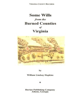
SOME WILLS FROM THE BURNED COUNTIES OF VIRGINIA compiled by William Lindsay Hopkins. 6x9 format. Wills from circa 1670-1830. Brunswick, Buckingham, Caroline, Charles City, Dinwiddie, Elizabeth City, Gloucester, Hanover, Henrico, James City, King George, King and Queen, King William, Mathews, Nansemond, New Kent, Prince George, Prince William, Stafford, and Warwick Counties, Va.

To view a digital copy of the index to this book, visit Index-Swbc
(Use your back arrow to return to Iberian's catalog)

Add to Cart

[Swbc] $32.00     (printed version)


The above title is also available as a digital e-book in PDF format:
Add to Cart

[ESwbc] $20.00     (electronic version)


For more records pertaining to JAMES CITY COUNTY, VIRGINIA see also:

|| Virginia/W.Va. || General Reference || Military Records ||
|| Other States || E-Books || New Titles
|| Home Page || E-Books ||

Copyright 2025 Iberian Publishing Company