ship logo General Reference Guides Census Records Military Records African-American Records Other States New Titles E-Books
          Home             Reference                 Census Records       Military           African-American         Other States         New Titles           E-BOOKS     FREE SHIPPING IN USA

Iberian Publishing Company's On-Line Catalog:
Charles City County Virginia


Map of Va: Charles City CountyOne of the original shires of Virginia. It was named for Charles City of Bermuda Hundred, which in turn honored the King of England. For the whole of the seventeenth century, Charles City County included territory on both sides of the James River. To the north it was bounded by the same three counties as at present. South of the river it was limited on the east by James City (Surry after 1752) County. To the west, Charles City County extended between the Appomattox River and the North Carolina line to the Blue Ridge Mountains. All of Charles City's lands south of the James were taken in 1703 to form Prince George County. In 1720 Charles City was enlarged when James City County's lands west of the Chickahominy River was added to it. At this point its boundaries stabilized and have not changed. Charles City County had been first settled in 1613, and among its early settlements, those of Smith's Hundred (1617), West and Shirley Hundred and Berkeley Hundred (1619), marked the Virginia frontier of the early decades of settlement.

For a better understanding of county boundary changes, see our new section Virginia in Maps
Iberian also has hundreds of titles in e book (PDF) format!! Click here for a complete online catalog of available titles
CHARLES CITY CO., VA 1810 CENSUS transcribed, with an index by John Vogt. 10 1/2 x 8 1/2, x, 23 pages, illustrations, maps, index.. This is the first surviving census for Charles City, since both the 1790 and 1800 censuses have been lost. A complete index is included for easy access. Charles City was an original shire whose settlement dated from the 1610s; by the 1810s it contained a number of large plantations with a heavy slave population, as well as smaller holdings in the upland country of the Ridgepath; in all, census record covers 414 households.
To view a digital copy of the index to this book, visit Index-1810-Charles City
(Use your back arrow to return to Iberian's catalog)
Add to Cart

[CC10] $9.95     (printed version)


The above title is also available as a digital e-book in PDF format:
Add to Cart

[ECC10] $7.00     (electronic version)


CHARLES CITY COUNTY, VIRGINIA, 1725-1731 by Benjamin B. Weisiger, III, 1984. 63 pages, index. Abstracts of a book carried off by Union troops in the Civil War and returned in the 1970s. There are numerous references to the burned counties of James City and New Kent.

To view a digital copy of the index to this book, visit Index-Ccbk
(Use your back arrow to return to Iberian's catalog)
Add to Cart

[Ccbk] $11.00     (printed version)


The above title is also available as a digital e-book in PDF format:
Add to Cart

[ECCBK] $7.00     (electronic version)


CHARLES CITY COUNTY, VIRGINIA, RECORDS, 1737-1774 by Benjamin B. Weisiger, III, 1986. 201 pages, index. The book contains abstracts of wills and deeds, 1763-1774, references to wills, estates, orphans, etc. in the Court Order Books, 1737-1761, a few fragments of wills, deeds and court orders, 1689-1690 and 1641-1642 and some loose documents.
To view a digital copy of the index to this book, visit Index-Ccrc
(Use your back arrow to return to Iberian's catalog)
Add to Cart

[Ccrc] $24.50     (printed version)


The above title is also available as a digital e-book in PDF format:
Add to Cart

[ECCRC] $18.00     (electronic version)


CHARLES CITY COUNTY, VIRGINIA COURT ORDERS, 1687-1695 (with a fragment of a Court Order Book for the year 1680) by Benjamin B. Weisiger, III, 1980. 249 pages, index. The present volume is chiefly an abstract of the Court Order Book for the period noted.
To view a digital copy of the index to this book, visit Index-Ccco
(Use your back arrow to return to Iberian's catalog)
Add to Cart

[Ccco] $24.95     (printed version)


The above title is also available as a digital e-book in PDF format:
Note: This is a large file (7.35MB)
Add to Cart

[ECCCO)] $18.00     (electronic version)


Charles City Co. 1815 Directory of Landowners by Roger G. Ward. 2005. 10 pages, map, 5 1/2X8 1/2.
For a full description of the 1815 LAND DIRECTORY Records and a listing of available counties, see combined volume below
Add to Cart

[Vd17] $6.00     (printed version)


The above title is also available as a digital e-book in PDF format:
Add to Cart

[EVd17] $4.00     (electronic version)


1815 DIRECTORY OF VIRGINIA LANDOWNERS & GAZETTEER, vol. 1 Central Region (Includes the counties of Albemarle, Amelia, Amherst, Buckingham, Charles City, Chesterfield, Cumberland, Dinwiddie, Fluvanna, Goochland, Hanover, Henrico, independent city of Petersburg, independent city of Richmond, Louisa, Nelson, New Kent, Nottoway, Powhatan, and Prince George.) abstracted by Roger G. Ward. 1997, vi, 239 pages, indices, maps.
In 1782 the General Assembly of Virginia enacted new tax laws which created within each county an enumeration of land and certain personal property. These early land tax laws required a tax commissioner in each district of a county to record a list of the names of persons owning land or town lots, the quantity of land owned and its value, and the amount of tax owed. By 1813, a brief geographic description (usually citing an adjacent stream, road, or other landmark) was required; in 1814, the distance and direction from the courthouse for each parcel was also added to the tax rolls.
The present work is an alphabetical listing of all 1815 landowners found in each county, as well as the accompanying description of the location of the said property. We have not included the number of acres, taxes assessed, or any transactions between landowners which may have been noted on the tax rolls; also, in many cases the geographic location was provided as "adjacent to John Smith", etc. and, while useful many times to a genealogist, was considered to be beyond the objectives of this project. The reader is encouraged to consider the information here-in as an "outline" of early landowners in Virginia rather than a "text" due to the year-to-year variation in information provided to the clerk (or recorded by the clerk), omissions, lack of "identifiers" to determine if "same name" was also "same person" within a district or across districts, marginal quality/clarity (in a few cases) of the microfilm copy, and, not least, errors on the part of either the original clerks or the current author while transcribing.
Some of the approaches to utilizing the 1815 landowner information include:
  1. observe distinct clusters of the same surname within a county in order to clarify the common surnames such as "Smith", "Anderson", etc;
  2. identify non-resident landowners and their county (or state) of residence (these people often being former residents of the current county);
  3. determine neighbors with different surnames (often being relatives);
  4. use the 1815 information as a "bridge" from the 18th and 19th century deed/will books to the 17th and 18th century land grants/patents in the county;
  5. evaluate the 1810 to 1840 census information which generally grouped neighbors;
  6. substitute this information for missing deed/will books in the "burned" counties; and, clarify/enhance vague deed/will information in the counties with more complete records.
FORMAT OF PRESENTATION: Each entry is listed as: Surname, name, personal identifiers (if any); location/place-name of land; miles/direction from the 1815 courthouse. If multiple owners are listed for a property, the listing is duplicated under each of the owner's surnames (i.e "Smith and Brown" is also listed as "Brown, --see Smith"); when multiple owners share a common surname, the property is only listed once. When a landowner had land at more than one location/place-name, the miles/direction listing for each parcel is in the same sequence as the location listing (i.e. James RV, Slate CK; 12N, 5SW.). In the few cases where a landowner had "many" parcels, the miles/direction notation is attached to the location listing (i.e. Sandy RV- 5NE, Willow CK-7S, etc.)

Add to Cart

[Vdl1] $32.00    (paper version)


The above title is also available as a digital e-book in PDF format:
Add to Cart

[EVDL-1] $20.00     (electronic version)


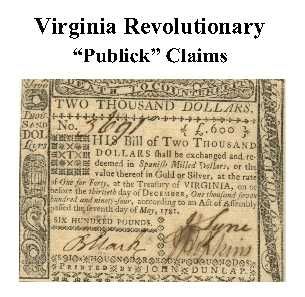
Charles City Co. Revolutionary Public Claims transcribed by Janice L. Abercrombie and Richard Slatten.. 2005. 30 pages, 5 1/2X8 1/2.
For a full description of the Virginia Revolutionary Public Claims and a listing of available counties, see:
Revolutionary "Publick" Claims series
To view a digital copy (pdf) of the index to this book, visit Index-Charles City
(Close the pdf file with the left arrow to return to Iberian's catalog)
Add to Cart

[Pc13] $6.00     (printed version)


The above title is also available as a digital e-book in PDF format:

Add to Cart

[EPc13] $3.50     (electronic version)


BURNED COUNTY DATA, 1809-1848 (AS FOUND IN THE VIRGINIA CONTESTED ELECTION FILES) by Benjamin B. Weisiger,III, 1986. 100 pages, index. The author has examined a previously unexplored source of information for valuable genealogical information regarding "burned counties." The bulk of the data consists of depositions regarding qualifications of the voter (e.g., land ownership, age, length of residence in the county, etc.) as well as data gleaned from a number of attached wills, deeds, and even a Bible register.

From the author’s introduction-

Genealogical research in the burned record counties of Virginia poses a real challenge. Any data that can add to our store of knowledge in this area is always helpful. An unexplored source of information is in the State Contested Election Files. These are found in boxes dating from 1790 to 1950. Data of a genealogical nature is found in the depositions regarding land ownership, age and length of residence in the county, as well as in a number of attached wills, deeds and even a Bible register.

The General Assembly in 1818 updated the election laws in regard to voter qualification. White male landowners had always been the only voters. The law of 1818 spelled out qualifications as follows:

"Every male citizen of the Commonwealth, aged twenty-one years (other than free negroes or mulattoes, or such as have refused to give assurance of fidelity to the Commonwealth), being possessed or, whose tenant for years at will or sufferance is possessed of twenty-five acres of land, with house, the superficial content of the foundation of which is twelve feet square, or equal to that quantity, and a plantation thereon, or fifty acres of unimproved land, or a lot or part of a lot in a city or town by act of General Assembly with a house thereon of the like superficial quantity, having in such land an estate of freehold at least, and unless the title shall have come to him by descent, devise, marriage or marriage settlement, having been so possessed for 6 months; and no other person shall be qualified to vote for delegates to serve in General Assembly for the county, city or borough respectively in which the land lieth. If the fifty acres of land, being one entire parcel, lie in several counties, the holder shall vote in the county where the greater part of the land lieth only; and if the twenty-five acres, being one entire parcel, be in several counties, the holder shall vote only in the county wherein the house standeth. In the right of land holden by parceners, joint tenants or tenants in common, but one vote shall be given by all the holders capable of voting, who may be present and agree to vote for the same candidate, or candidates, unless the quantity of land in case partition had been made thereof, be sufficient to entitle every holder to vote separately, or unless some one or more of the holders may lawfully vote in right of another estate or estates in the same county; in which case the others may vote, if holding solely they might have voted; provided nevertheless that no person inhabiting the District of Columbia or elsewhere not within the jurisdiction of this Commonwealth shall be entitled to exercise the right of suffrage therein, except citizens thereof employed abroad in the service of the United States or of this Commonwealth, and whose foreign residence is occasioned by such service."

The procedure in contested elections was also specified in the law. There was no secret ballot, so that the contestants knew who voted for and against them.

The following counties and elections are included in the current volume: Hanover (1825); Buckingham (1809, 1840, 1848); Charles City (1821, 1838); Gloucester (1827); New Kent (1838); James City (1845); and Caroline (1843).
In the preparation of this book only the burned record counties were surveyed, up to 1850.

The reader is advised to go to the original if he or she finds data of interest here.

To view a digital copy of the index to this book, visit Index-Burn
(Use your back arrow to return to Iberian's catalog)
Add to Cart

[Burn] $17.00     (printed version)


The above title is also available as a digital e-book in PDF format:
Add to Cart

[EBurn] $10.00     (electronic version)


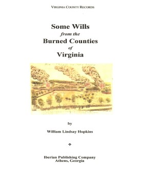
SOME WILLS FROM THE BURNED COUNTIES OF VIRGINIA compiled by William Lindsay Hopkins. 6x9 format. Wills from circa 1670-1830. Brunswick, Buckingham, Caroline, Charles City, Dinwiddie, Elizabeth City, Gloucester, Hanover, Henrico, James City, King George, King and Queen, King William, Mathews, Nansemond, New Kent, Prince George, Prince William, Stafford, and Warwick Counties, Va.

To view a digital copy of the index to this book, visit Index-Swbc
(Use your back arrow to return to Iberian's catalog)

Add to Cart

[Swbc] $32.00


The above title is also available as a digital e-book in PDF format:
Add to Cart

[ESwbc] $20.00     (electronic version)


For more records pertaining to CHARLES CITY COUNTY, VIRGINIA see also:


/

Please see our HELP PAGE for mail-order instructions, wholesaler policies and other contact information.

|| Virginia/W.Va. || General Reference || Military Records ||
|| Other States || E-Books || New Titles
|| Home Page || E-Books ||

Copyright © 2026 Iberian Publishing Company