 HENRY COUNTY, VA 1810 SUBSTITUTE CENSUS [Abstracts from the 1810 Personal Property Tax List]
by John Vogt, 2011, 5 1/2"x8 1/2" format, viii, 8 pages, map.
HENRY COUNTY, VA 1810 SUBSTITUTE CENSUS [Abstracts from the 1810 Personal Property Tax List]
by John Vogt, 2011, 5 1/2"x8 1/2" format, viii, 8 pages, map.
Henry is one of eighteen Virginia counties for which the 1810 census is lost. In August, 1814 British troops occupied Washington, DC and public buildings were put to the torch. In the destruction that followed, numerous early records of the government were lost, including all of Virginia’s 1790 and 1800 census reports, as well as eighteen county lists for the state's most recent [1810] federal census. Although two “fair copies” of each county’s census had been left in the counties for public display, these were ephemeral lists and not preserved, and by 1814 they too had been mislaid, lost, or destroyed. Hence, the closest document available we have to reconstruct a partial image of the missing county lists is the personal property tax list.
According to research notes by Minor T. Weisiger, Library of Virginia archivist:
“Information recorded in Virginia personal property tax records changed gradually from 1782 to 1865. The early laws required the tax commissioner in each district to record in “a fair alphabetical list” the names of the person chargeable with the tax, the names of white male tithables over the age of twenty-one, the number of white male tithables between ages sixteen and twenty-one, the number of slaves both above and below age sixteen, various types of animals such as horses and cattle, carriage wheels, ordinary licenses, and even billiard tables. Free Negroes are listed by name and often denoted in the list as “free” or “FN.”
The present abstract of Henry's 1810 personal property tax list is NOT a transcript of the entire document; rather, it is a summary of three items important in delineating the 1810 "substitute" census for this county, i.e., number of male tithables 16 and older, number of slaves twelve years and older, and the number of horses. The original form of the census was in alphabetic order by date and letter. The substitute list presented here is in absolute alphabetic order for easy reference.
In the current volume, the data is recorded thus:
Beck, Robert 1 - 2
Bellama, John 1 - 1
Booker, Richard E. 1 - -
Bouldin, Green 2 6 5
Column one represents the tithable males (16 and over) in the household; column 2 is the number of slaves over 12; and the final column is the number of horses, mares or mules.
For genealogical researchers in this 1810 period, personal property tax records may provide additional important information. Oftentimes, juniors and seniors are listed adjacent to one another and recorded on the same day. When a taxpayer is noted as “exempt”, it can be a clue to someone holding a particular position in government or being elderly, infirm, or for some other reason no longer required to pay the tithable tax. Women, both black and white, appear occasionally as heads of households when they own property in their own right or as the widow of a property owner.
Another valuable source for filling in information about an ancestor is the land tax record, and especially the one for 1815. In that year, the enumerators began to add the location of the property in relation to the county court house. Roger Ward has abstracted all of the 1815 land tax records, and they are available from this publisher at www.iberian.com.
The 1810 substitute census list for Henry County contains 618 households, 846 tithables, both white and free black, and 938 slaves over the age of twelve, and 1,748 horses.
SURNAMES included in the 1810 personal property list are:
Abbington; Agee; Akin; Alexander; Allen; Amoss; Anderson; Anglin; Anthony; Arnold; Atkinson;
Bailey; Baker; Barksdell; Barnes; Barnton; Bassett; Bayse; Beck; Bellama; Booker; Bouldin; Bradberry; Brashears; Brewer; Bryant; Bundren; Bundrin; Burch; Burchett; Burgess; Burrass; Burton; Butcher;
Cahill; Carr; Carter; Cary; Cayton; Chapman; Cheatham; Cheely; Chesher; Chowning; Christian; Clanton; Clark; Clarke; Clifton; Clinton; Cole; Conaway; Conner; Cooksey; Copeland; Corsey; Cousins; Cox; Creasy; Crunk; Cumpton; Custer;
Dandridge; Daniel; Davis; Dent; Dickenson; Dikes; Dillard; Dillen; Dillon; Dishazo; Dix; Dold; Draper; Durham; Dyer;
East; Eckols; Edwards; Eggleton; Emmerson; Evins;
Farris; Fee; Ferris; Fifer; Fleeman; Fontaine; Fortune; Foster; France; Francis; Franklin; Frazer;
Garland; Garner; Gilley; Gilly; Gilmer; Gilpin; Glass; Going; Graves; Gravley; Green; Griffin; Grigg; Griggs; Grigs;
Hairfield; Hairston; Halcom; Hale; Haley; Hanby; Hancock; Hankins; Happer; Harbour; Hardy; Harris; Harvell; Harvey; Haskins; Hatcher; Hayse; Heard; Hebbert; Hefflefinger; Hemmings; Hendren; Hensley; Hereford; Hewlett; Higgs; Hill; Holt; Hopper; Hopson; Howard; Hughes; Humphries; Hunt; Hunter;
Ivey;
Jackson; Jamerson; Jarriott; Jarvis; Jinkins; Johnston; Jones;
Kelley; Kelso; Kernel; Key; Kindrick; King; Kington;
Lampkin; Lanier; Larke; Larrance; Larrison; Lawless; Layne; Leake; Leshore; Lewis; Long; Lovell; Lyell; Lyle;
Marshal; Martial; Martin; Mason; Maupin; Mayo; Mayse; McCullah; McDaniel; McKinsey; McKown; McMillian; Meridith; Merrideth; Mill; Mills; Mintor; Molin; Moor; Moore; Morgan; Morris; Mullins; Murphy;
Nance; Newsome; Nicholds; Nixson; Norman; Norris; Northcutt; Nunn;
Oakes; Oakley; Oldham; Owin;
Pace; Parkerson; Pasley; Paterson; Paul; Payne; Pearson; Pedigo; Petty; Phillips; Philpott; Postin; Pratt; Price; Proctor; Pullam; Pusley; Pyrtle;
Quales;
Ramey; Ransom; Ray; Rea; Read; Redd; Richardson; Roach; Roberts; Robertson; Rodgers; Rodgers; Rowland; Royster; Rucard; Ryan;
Salmon; Samms; Shackelford; Shelton; Shewmake; Simpson; Smith; Snell; Southworth; Spencer; Stacy; Standley; Staples; Starling; Stone; Stuart; Stults; Sutton;
Taylor; Terry; Thacker; Thomerson; Tooms; Travis; Trent; Truhearn; Turner;
Valentine; Vaughan; Verdell;
Wade; Waller; Warren; Watkins; Watson; Weaver; Webb; Wells; Whitecotton; Williams; Wilson; Witt; Woodson; Worsham; Wyatt;
[HYPP] $4.00 (printed version)
The above title is also available as a digital e-book in PDF format:
[EHYPP] $2.50 (electronic version)
ENTRY RECORD BOOK [1], 1737-1770 (Land entries in the present Virginia counties of Halifax, Pittsylvania, Henry, Franklin, & Patrick)
transcribed by Marian Dodson Chiarito. 1984. 432 pages, 8" x 11. This book contains land entries in the western
portion of the original Brunswick County. The area concerned was south of Blackwater Creek and
Roanoke-Stanton River, west of Aaron's Creek (which divides Mecklenburg and Halifax counties), and
extended to the Blue Ridge Mountains. The North Carolina line was the southern boundary. A complete
index of all names, watercourses, mountains, etc.
To view a digital copy of the index to this book, visit Index-Erb1
(Close the pdf file with the left arrow to return to Iberian's catalog)
[Erb1] $47.95
The above title is also available as a digital e-book in PDF format:
[EERB1] $30.00 (electronic version)
ENTRY RECORD BOOK [2], 1770-1796 (Land entries in the present Virginia counties of Pittsylvania, Henry, Franklin, & Patrick)
transcribed by Marian Dodson Chiarito. 1988. 138 pages, 8" x 11. This book is a sequel to Entry Record Book
[1], 1737-1770, published in 1984. The watercourses listed in the index indicate that the area for this volume
was Pittsylvania County as it existed in 1770. Pittsylvania was formed from Halifax County in 1767. The map
included with the book gives names of most of the early watercourses, and makes possible the location of land
entries, adjoining landowners, and other points of interest. A complete index of all names, watercourses,
mountains, etc. is provided.
To view a digital copy of the index to this book, visit Index-Erb2
(Close the pdf file with the left arrow to return to Iberian's catalog)
[Erb2] $27.00
The above title is also available as a digital e-book in PDF format:
[EERB2] $20.00 (electronic version)
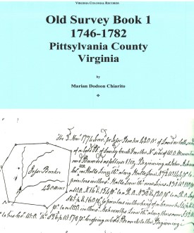 OLD SURVEY BOOK 1, 1746-1782, PITTSYLVANIA COUNTY, VIRGINIA
transcribed by Marian Dodson Chiarito. 1988. 400 pages, 8" x 11.
OLD SURVEY BOOK 1, 1746-1782, PITTSYLVANIA COUNTY, VIRGINIA
transcribed by Marian Dodson Chiarito. 1988. 400 pages, 8" x 11.
PLEASE NOTE: This book contains surveys of land in
Pittsylvania County as it existed in 1767 when it was created from Halifax County. Until 1776, when Henry
County was formed, the counties of Henry, Franklin, and Patrick are also included.
It consists primarily of a
photocopy of the original surveys found in Old Survey Book 1. The map included with the book gives names
of most of the early watercourses, and makes possible the location of land surveys, adjoining landowners, etc.
A complete index of all names, watercourses, roads, etc. is provided.
To view a digital copy of the index to this book, visit Index-Pts1
(Close the pdf file with the left arrow to return to Iberian's catalog)
[Pts1] $37.00
The above title is also available as a digital e-book in PDF format:
[EPts1] $25.00
[EPts1] $25.00
An Important Revolutionary War Title!
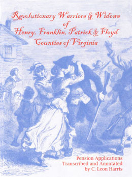 Revolutionary Warriors and Widows of Henry, Franklin, Patrick and Floyd Counties of Virginia: Pension Applications
Transcribed and Abstracted by C. Leon Harris
Revolutionary Warriors and Widows of Henry, Franklin, Patrick and Floyd Counties of Virginia: Pension Applications
Transcribed and Abstracted by C. Leon Harris
To view a digital copy of the index to this book, visit Index-Rww
(Close the pdf file with the left arrow to return to Iberian's catalog)
For a complete description see the separate page on this title
8 ¼" x 10 ¼" format, xiv, 376 pages, color cover, internal illustrations, bibliography, comprehensive index, maps, charts, graphs. Paperback.
[Rww] $31.95







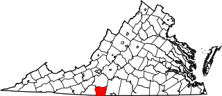 Henry County was created on 31 Dec. 1776 from the western border lands of Pittsylvania County. Its name honored Patrick Henry, Governor of Virginia. Nine years later, in 1785, the northern portion of the new county was cut off to form a part of Franklin County. In 1790 Patrick County was formed from the western part of Henry, and an additional small piece was transferred from Henry to Patrick in 1791. The final boundary change for Henry County occurred in 1858 when thirty-four square miles of Patrick County was transferred to Henry County's authority.
The county's records are complete, with the exception of the early land surveys, which were lost
Henry County was created on 31 Dec. 1776 from the western border lands of Pittsylvania County. Its name honored Patrick Henry, Governor of Virginia. Nine years later, in 1785, the northern portion of the new county was cut off to form a part of Franklin County. In 1790 Patrick County was formed from the western part of Henry, and an additional small piece was transferred from Henry to Patrick in 1791. The final boundary change for Henry County occurred in 1858 when thirty-four square miles of Patrick County was transferred to Henry County's authority.
The county's records are complete, with the exception of the early land surveys, which were lost
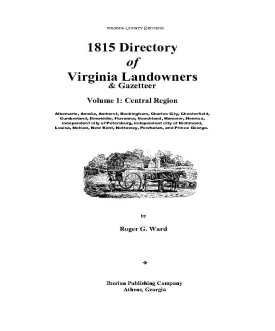 1815 DIRECTORY OF VIRGINIA LANDOWNERS & GAZETTEER, vol. 2 South Central Region
(Includes the counties of Bedford, Brunswick, Campbell, Charlotte, Franklin,
Greensville, Halifax, Henry, Lunenburg, Mecklenburg, Patrick, Pittsylvania, Prince Edward, Southampton, and Sussex) abstracted by Roger G. Ward. 1997, vi, 234 pages, indices, maps.
1815 DIRECTORY OF VIRGINIA LANDOWNERS & GAZETTEER, vol. 2 South Central Region
(Includes the counties of Bedford, Brunswick, Campbell, Charlotte, Franklin,
Greensville, Halifax, Henry, Lunenburg, Mecklenburg, Patrick, Pittsylvania, Prince Edward, Southampton, and Sussex) abstracted by Roger G. Ward. 1997, vi, 234 pages, indices, maps.
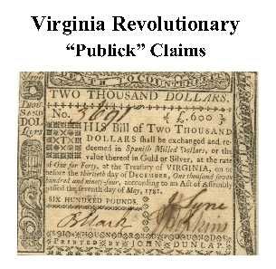 Henry Co. Revolutionary Public Claims
transcribed by Janice L. Abercrombie and Richard Slatten.. 2005. 53 pages, 5 1/2X8 1/2.
Henry Co. Revolutionary Public Claims
transcribed by Janice L. Abercrombie and Richard Slatten.. 2005. 53 pages, 5 1/2X8 1/2.


