Wood Co. 1815 Directory of Landowners
by Roger G. Ward. 2005. 25 pages, map, 5 1/2X8 1/2.
For a full description of the 1815 LAND DIRECTORY Records and a listing of available counties, see combined volume below
Surnames in this county directory:
Adams; Albin; Alfin; Allen; Anderson; Anthony; Arnold; Ashford; Athey; Atkinson; Backus; Badgley; Baer; Bailey; Baldwin; Banks; Barnes; Barnett; Barr; Barrett; Bauman; Baun?; Bayley; Bealor; Beaty; Beauchamp; Beckwith; Beebe; Beers; Beeson; Bennett; Berkey; Blair; Bodkin; Boggs; Bogle; Boli; Booth; Bose; Brown; Brubaker; Buckner; Burroughs; Butcher; Butler; Caldwell; Campbell; Cane; Caplinger; Casshill; Chalmers; Chamberlain; Champlin; Chaplin; Chapman; Clark; Clibourn; Click; Cockrell; Coe; Coleman; Collins; Combs; Compton; Conrad; Conwell; Cook; Cooper; Coplin; Corbet; Coult; Cradlepaugh; Craig; Crain; Creel; Crissap; Cryer; Curtiss; Cutright; Davis; Davison; Dawkins; Deacon; DeBartholt; Deem; Dennyberger; Deputy; Dewey; Die; Dils; Dixon; Doddridge; Dotson; Douglass; Drake; Dubois; Dutton; Duvall; Dyar; Dye; Dyer; Eastburn; Eaton; Edelin; Enoch; Eskridge; Felison?; Ferry; Finnamore; Fisher; Foley; Forde; Foster; Foughty; Foulks; Fox; French; Gates; Gibbs; Gibson; Gill; Gillespie; Gilman; Gilman; Glaspy?; Glass; Glaze; Graham; Gray; Griffin; Griffith; Grove; Guard; Gulick; Hall; Hamilton; Hanaman; Hanaway; Hanson; Harris; Harrison; Harter; Hartshorn; Hartung; Harwood; Haymond; Heaton; Heft; Henderson; Hendrickson; Henry; Henshaw; Hervey; Hiatt; Hickman; Hill; Hines; Hodgdon; Holmes; Hopkings; Hopkins; Horst; House; Howdershill; Howell; Huff; Hugh; Hunt; Hunter; Husher; Huston; Hutchinson; Hyatt; Ingles; Irwin; Israel; Jackson; Jacobs; James; Jenkins; Jett; John; Johnson; Jones; Jordan; Keene; Keller; Kendle; Keys; Kimble; King; Kintcheloe; Kite; Lacy; Laidley; Lamb; Lamot; Lane; Langfit; Leach; Leachman; Lee; Lefavre; Lefever; Lennox; Lewellyn?; Lewis; Livingston; Lloyd; Lockhard; Lockhart; Lownes; Lowther; Lyons; Maddox; Madson; Mann; Marsh; Marshall; Martin; Mattsby; Mayberry; Maylor; McCall; McClain; McClelan; McClery; McClure; McCoul; McFarland; McGraw; McIves; McKervan; McKewan; McKinney; McMullen; McRae; Mealey; Melcher; Miller; Milrose; Mitchell; Mitchel; Mittany; Moor; Morehead; Morris; Morrison; Murdough; Naylor; Neale; Newell; Newkirk; Niesly; Norton; O'Finn; Ogden; Ogleby; OHarra; Owens; Owings; Owl; Page; Parrish; Patton; Payne; Pelph; Pennell; Pennybacker; Perine; Petty; Petzer; Phelps; Philips; Pilcher; Pittman; Pleasants; Polk; Post; Powers; Pratt; Preble; Prentiss; Price; Prince; Prindle; Proctor; Province; Pryor; Pugh; Purviance; Quarrier; Quimby; Radcliff; Ralph; Ralston; Randall; Rawson; Redford; Redman; Reede; Reeder; Renick; Renshaw; Richards; Richardson; Rigg; Rightmere; Riley; Ringgold; Robertson; Robinson; Rockhold; Rogers; Rohrer; Roquet; Rose; Rowson; Ruble; Rumney; Rush; Rutherford; Salstonstall; Samuels; Saunders; Saunderson; Savery; Say; Schultz; Scott; Selden; Serjeant; Shanklin; Sharp; Shearman; Shepherd; Simpson; Sims; Six; Skelton; Slate; Slusser; Smith; Snowden; Snyder; Spencer; Stanley; Starr; Steed; Stephens; Stephenson; Stevens; Stewart; Stoats; Stokely; Strobs; Sturgeon; Sutherland; Sweitzer; Switzer; Talbot; Tavener; Terrell; Terry; Thomas; Thornton; Tims; Tingle; Titmus; Tobin; Tomlinson; Topliff; Triplet; Triplett; Tudor; Turley; Turner; Uhl; Ulix; Van Braam; Van Ransselaur; Vandover; Vanmeter; Vanolara; Varden; Vought; Waddington; Walbridge; Waldon; Washbourn?; Washington; Watkins; Watson; Webster; Weld; Wells; West; Westfall; Wheat; Wheaton; White; Whittlesay; Williams; Williamson; Willis; Wills; Wilson; Winn; Wiseman; Wood; Woodbridge; Woods; Woodyard; Woolf; Woolfe; Worth; Young; and Zane;
[Vd104] $8.00
The above title is also available as a digital e-book in PDF format:
[EVd104] $5.50 (electronic version)
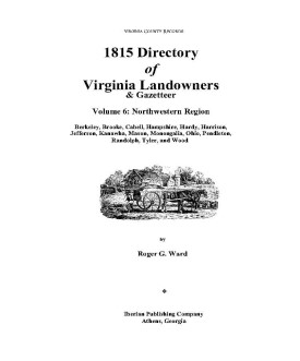 1815 DIRECTORY OF VIRGINIA LANDOWNERS & GAZETTEER, vol. Northwest Region
(Includes the counties of Berkeley, Brooke, Cabell, Hampshire, Hardy, Harrison, Jefferson, Kanawha, Mason, Monongalia, Ohio, Pendleton, Randolph, Tyler, and Wood ) abstracted by Roger G. Ward. 1997, vi, 232 pages, indices, maps.
1815 DIRECTORY OF VIRGINIA LANDOWNERS & GAZETTEER, vol. Northwest Region
(Includes the counties of Berkeley, Brooke, Cabell, Hampshire, Hardy, Harrison, Jefferson, Kanawha, Mason, Monongalia, Ohio, Pendleton, Randolph, Tyler, and Wood ) abstracted by Roger G. Ward. 1997, vi, 232 pages, indices, maps.
In 1782 the General Assembly of Virginia enacted new tax laws which
created within each county an enumeration of land and certain personal property. These
early land tax laws required a tax commissioner in each district of a county to record a
list of the names of persons owning land or town lots, the quantity of land owned and its
value, and the amount of tax owed. By 1813, a brief geographic description (usually
citing an adjacent stream, road, or other landmark) was required; in 1814, the distance
and direction from the courthouse for each parcel was also added to the tax rolls.
The present work is an alphabetical listing of all 1815 landowners found in
each county, as well as the accompanying description of the location of the said property.
We have not included the number of acres, taxes assessed, or any transactions between
landowners which may have been noted on the tax rolls; also, in many cases the
geographic location was provided as "adjacent to John Smith", etc. and, while useful many
times to a genealogist, was considered to be beyond the objectives of this project. The
reader is encouraged to consider the information here-in as an "outline" of early
landowners in Virginia rather than a "text" due to the year-to-year variation in
information provided to the clerk (or recorded by the clerk), omissions, lack of
"identifiers" to determine if "same name" was also "same person" within a district or
across districts, marginal quality/clarity (in a few cases) of the microfilm copy, and, not
least, errors on the part of either the original clerks or the current author while
transcribing.
Some of the approaches to utilizing the 1815 landowner information include:-
observe distinct clusters of the same surname within a county in order to clarify
the common surnames such as "Smith", "Anderson", etc;
- identify non-resident landowners and their county (or state) of residence (these
people often being former residents of the current county);
- determine neighbors with different surnames (often being relatives);
- use the 1815 information as a "bridge" from the 18th and 19th century deed/will
books to the 17th and 18th century land grants/patents in the county;
- evaluate the 1810 to 1840 census information which generally grouped
neighbors;
- substitute this information for missing deed/will books in the "burned" counties;
and, clarify/enhance vague deed/will information in the counties with more complete
records.
FORMAT OF PRESENTATION: Each entry is listed as: Surname,
name,
personal identifiers (if any); location/place-name of land; miles/direction from the 1815
courthouse. If multiple owners are listed for a property, the listing is duplicated under
each of the owner's surnames (i.e "Smith and Brown" is also listed as "Brown, --see
Smith"); when multiple owners share a common surname, the property is only listed
once. When a landowner had land at more than one location/place-name, the
miles/direction listing for each parcel is in the same sequence as the location listing (i.e.
James RV, Slate CK; 12N, 5SW.). In the few cases where a landowner had "many"
parcels, the miles/direction notation is attached to the location listing (i.e. Sandy RV-
5NE, Willow CK-7S, etc.)
[Vdl6] $32.00 (paper version)
The above title is also available as a digital e-book in PDF format:
[EVDL-6] $20.00 (electronic version)
For records pertaining to WOOD COUNTY, VIRGINIA see:
Chart on the Formation of Virginia Counties
Atlas of County Boundary Changes in Virginia, 1634-1895
Index to the 1810 Virginia Census


Please see our HELP PAGE for mail-order instructions, wholesaler policies and other contact information.
|| Virginia/W.Va. || General Reference || Military Records ||
|| Other States || Genealogy Links || New Titles || Home Page || E-Books ||
Copyright 2026 Iberian Publishing Company







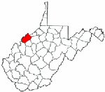 Wood County was formed in 1798 from the western part of Harrison County and it was named for James Wood, governor of Virginia from 1796 to 1799. In 1800 Kanawha gave land to Wood. In turn, Wood ceded land in the formation of several counties: Jackson (1831), Ritchie (1843), Wirt (1848 & 1863), Pleasants (1851).
 Wood County,Virginia 1810 Federal Census: A Transcription with index