Iberian Publishing Company's On-Line Catalog: Spotsylvania County Virginia
Spotsylvania County was established on 1 May 1721 from the upper portions of King & Queen, King William, and Essex counties. The county's name honored Alexander Spotswood, lieutenant governor of Virginia from 1710 to 1722. Spotsylvania county reached its present boundary configuration after Orange County was cut from its western territory in 1734.
Since the lands encompassed by Spotsylvania fell within the bounds of the Indian Reserve, settlers who first moved into the region in the mid-seventeenth century had to barter with the natives for rights to occupy lands there.
The records for the county are intact, although a number of records are held by the Fredericksburg circuit court (early sessions of the courts of the Spotsylvania judicial district were held at the Fredericksburg courthouse).







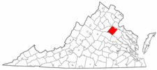 Spotsylvania County was established on 1 May 1721 from the upper portions of King & Queen, King William, and Essex counties. The county's name honored Alexander Spotswood, lieutenant governor of Virginia from 1710 to 1722. Spotsylvania county reached its present boundary configuration after Orange County was cut from its western territory in 1734.
Since the lands encompassed by Spotsylvania fell within the bounds of the Indian Reserve, settlers who first moved into the region in the mid-seventeenth century had to barter with the natives for rights to occupy lands there.
The records for the county are intact, although a number of records are held by the Fredericksburg circuit court (early sessions of the courts of the Spotsylvania judicial district were held at the Fredericksburg courthouse).
Spotsylvania County was established on 1 May 1721 from the upper portions of King & Queen, King William, and Essex counties. The county's name honored Alexander Spotswood, lieutenant governor of Virginia from 1710 to 1722. Spotsylvania county reached its present boundary configuration after Orange County was cut from its western territory in 1734.
Since the lands encompassed by Spotsylvania fell within the bounds of the Indian Reserve, settlers who first moved into the region in the mid-seventeenth century had to barter with the natives for rights to occupy lands there.
The records for the county are intact, although a number of records are held by the Fredericksburg circuit court (early sessions of the courts of the Spotsylvania judicial district were held at the Fredericksburg courthouse).
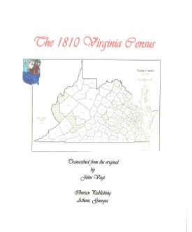 Spotsylvania County,Virginia 1810 Federal Census: A Transcription
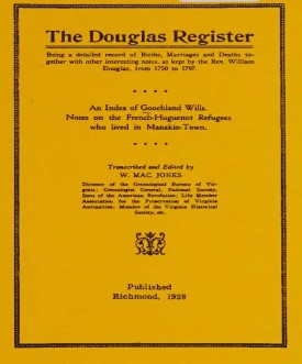 THE DOUGLAS REGISTER, Being a detailed record of Births, Marriages and Deaths together with other interesting notes, as kept by the Reverend William Douglas, from 1750 to 1797 [With an Index of Goochland Wills and Notes on the French Huguenot Refugees who Lived in Manakin-Town].
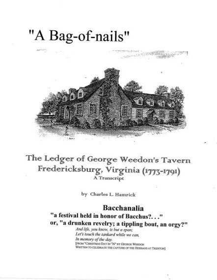 A BAG OF NAILS: THE LEDGER OF GEORGE WEEDON'S TAVERN, FREDERICKSBURG, VA, 1773-1791
Transcribed by Charles Hamrick 2007, xxvi, 196 pp. The Rising Sun Tavern (aka Weedon's) was perhaps the most important establishment for travelers in northern Virginia prior to the Revolution. Weedon himself was an ardent patriot, and those of like mind gathered at his establishment to debate the issues of the times. It was here that Thomas Jefferson
convened his friends to draft bills of religious freedom and public schools which later were enacted by the Va. General Assembly. This Virginia statute inspired the First Amendment to the United States Constitution. Weedon's account book is a window into the daily life of the tavern and its visitors. The Ledger book reproduced here is more than a mere listing of goods and services. It is a time capsule of life in Virginia during the early Revolutionary period. What people did, ate, and purchased speaks volumes about the personalities of the individuals, and any genealogist with ancestors in this area can begin to see a complete picture of life during the late colonial period. Here are recorded the men who came to discuss politics, enjoy the race season, and even take in a play performance or two as recreation.
A BAG OF NAILS: THE LEDGER OF GEORGE WEEDON'S TAVERN, FREDERICKSBURG, VA, 1773-1791
Transcribed by Charles Hamrick 2007, xxvi, 196 pp. The Rising Sun Tavern (aka Weedon's) was perhaps the most important establishment for travelers in northern Virginia prior to the Revolution. Weedon himself was an ardent patriot, and those of like mind gathered at his establishment to debate the issues of the times. It was here that Thomas Jefferson
convened his friends to draft bills of religious freedom and public schools which later were enacted by the Va. General Assembly. This Virginia statute inspired the First Amendment to the United States Constitution. Weedon's account book is a window into the daily life of the tavern and its visitors. The Ledger book reproduced here is more than a mere listing of goods and services. It is a time capsule of life in Virginia during the early Revolutionary period. What people did, ate, and purchased speaks volumes about the personalities of the individuals, and any genealogist with ancestors in this area can begin to see a complete picture of life during the late colonial period. Here are recorded the men who came to discuss politics, enjoy the race season, and even take in a play performance or two as recreation.  1815 DIRECTORY OF VIRGINIA LANDOWNERS & GAZETTEER, vol. 4 Northern Region
(Includes the counties and cities of Alexandria (i.e., present-day Arlington), Culpeper, Fairfax, Fauquier, Frederick, Loudoun, Madison, Orange, Prince William, Rockingham, Shenandoah, Spotsylvania, Stafford, and the independent cities of Alexandria, Fredericksburg, and Winchester ) abstracted by Roger G. Ward. 1997, vi, 220 pages, indices, maps.
1815 DIRECTORY OF VIRGINIA LANDOWNERS & GAZETTEER, vol. 4 Northern Region
(Includes the counties and cities of Alexandria (i.e., present-day Arlington), Culpeper, Fairfax, Fauquier, Frederick, Loudoun, Madison, Orange, Prince William, Rockingham, Shenandoah, Spotsylvania, Stafford, and the independent cities of Alexandria, Fredericksburg, and Winchester ) abstracted by Roger G. Ward. 1997, vi, 220 pages, indices, maps.
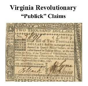 Spotsylvania Co. Revolutionary Public Claims
transcribed by Janice L. Abercrombie and Richard Slatten.. 2005. 52 pages, 5 1/2X8 1/2.
Spotsylvania Co. Revolutionary Public Claims
transcribed by Janice L. Abercrombie and Richard Slatten.. 2005. 52 pages, 5 1/2X8 1/2.


