ship logo General Reference Guides Census Records Military Records African-American Records Other States New Titles E-Books
          Home             Reference                 Census Records       Military           African-American         Other States         New Titles           E-BOOKS     FREE SHIPPING IN USA

Iberian Publishing Company's On-Line Catalog:
Madison County Virginia


Map of Va: Madison CountyMadison County was created in 1793 from the southwestern portion of Culpeper County. It honored James Madison, "Father of the American Constitution" and later President of the United States. Its boundaries have remained stable since that time. The earliest land patents in the area date from 1732, and German settlers began to migrate into the area bounded by Madison during the early 1720s. Hebron Church, situated on the Robinson River, was one of the earliest and most successful of the German Lutheran congregations in America. Here could be found numerous families who migrated away from Governor Spotswood's Germanna Colony in search of new lands. From here, families drifted into the Blue Ridge and beyond into the Shenandoah Valley to join the Pennsylvanian Germans already settled there.

For a better understanding of county boundary changes, see our new section Virginia in Maps
Iberian also has hundreds of titles in e book (PDF) format!! Click here for a complete online catalog of available titles
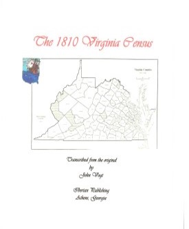
Madison County,Virginia 1810 Federal Census: A Transcription
John Vogt, 2007, iv, 17 pp., arranged by alpha letter. Census returns are some of the first records that a genealogist turns to when studying a new family line. Unfortunately for Madison County, as well as Virginia as a whole, both the 1790 and 1800 census reports for that state are lost. While the reason for their loss is argued, they nevertheless no longer exist. While personal property tax and land tax lists (which date from 1782) can be used to give some information about individuals, they do not give the researcher a glimpse into family composition or a snapshot of the county as a whole. Hence Madison's 1810 census is the first real window we have from the census records of this county which had been settled a century before and whose western boundary was the top of the Blue Ridge Mountains.
With the advent of the computer age and the publication of most of these early censuses, one would expect that many of the genealogist's problems would be resolved. Unfortunately, this has not happened. While many researchers rely completely upon online census records, these are often flawed by misread names and missing names altogether. The problem is the difficult reading of the documents, which often are written in a tight, cramped hand and with a myriad of possible readings. The close similarity between "S" and "L," "F" and "T", and recognizing the secretarial s, which appears as "ss" in the middle of words but not as an ending, can lead to nightmares in translation. Oftentimes, there is no distinction between an "e", an "o", and an "a" unless the reader is familiar with the family names within the document. These are only a few visual issues facing the transcriber. The author has been fortunate to have a professional background in paleography and history, both medieval and modern. In transcribing the current volume, comparison was made with other documents, as well as carefully examining each questionable character under magnification to ascertain the true intent of the writer. In the process, it became apparent that sometimes the census recorder himself was not familiar with strange-sounding German names or heavy Scottish brogues. One spelling would appear in the first encounter with the family, and then later on in the document a different spelling would be given for the same family surname. In brief, computerized lists, while useful, do not give a total and accurate picture of the data. The census was recorded in booklet form, consisting of twenty sheets of paper that were folded in the middle and written on in landscape fashion. So when the first half of the first page was filled with information and turned over, the back of that sheet became page two. In addition, the census enumerator conserved paper by writing in a very tiny hand, and herein lies the problem with "a", "e" and "o" in the body of a name. Only by carefully examining the transitions between characters can an accurate reading be obtained.

Surnames from the census:
Agan; Ahart; Ahart; Allen; Anderson; Andrews; Archer; Aylor; Back; Baily; Baker; Ballard; Banks; Barbour; Barnes; Barnett; Bates; Batton; Beal; Beckham; Berry; Bickers; Blakey; Blankenbeker; Blunt; Bohannon; Booker; Booten; Bowlin; Bradford; Bradly; Braner; Breden; Brickard; Briggs; Brock; Bronaugh; Brooking; Brooks; Brown; Broyles; Bryant; Burbridge; Burnett; Burriss; Bush; Bussell; Canady; Carder; Carpenter; Carter; Cauthron; Cave; Chapman; Chatham; Cheek; Chelf; Chelph; Clack; Clatterbuck; Clore; Cobler; Coleman; Collins; Cook; Corbin; Cox; Crigler; Crow; Cubbage; Davis; Deboard; Deer; Delph; Dobbs; Duff; Dulany; Early; Eastham; Eddins; Edwards; Estes; Fanny; Faukner; Field; Finks; Fishback; Fleshman; Floyd; Ford; Foster; Fox; Fray; Fry; Fulks; Gaar; Gains; Gallohugh; Garnett; Garriott; Garten; Gee; George; Gibbs; Glassell; Good; Gowen; Graves; Grayson; Green; Griffen; Grimsley; Gully; Hagirt; Harberson; Harrison; Hartsuck; Harvey; Hassel; Haynes; Henderson; Henshaw; Hensley; Herndon; Hill; Hollenback; Holmes; Holtzclaw; Hood; Hooper; Houlder; Houltzclaw; House; Howell; Hudgeon; Huffman; Hume; Hundley; Hunt; Hunter; Hurt; Hutcheson; Hutson; Jackson; James; Jarrell; Jennings; Jinkins; Johnston; Jones; Jordine; Kanady; Kemper; Kirtly; Klugh; Kyle; Lacey; Lackey; Layton; Leach; Leathers; Lewis; Lightfoot; Lillard; Limerick; Lindsey; Lipp; Lockson; Long; Loyd; Lumpkin; Macon; Madison; Major; Mallory; Marquess; Marshel; Mason; May; McCollester; McDaniel; McKenzie; McQuin; Medley; Miller; Milton; Mitchell; Moore; Morgan; Morris; Moubray; Murphey; Murry; Newman; Nickols; Nooe; Ody; Overton; Petty; Pilcher; Pollard; Porter; Powell; Pratt; Prise; Rambottom; Razer; Razor; Reddish; Redwell; Rice; Richards; Rider; Rinden; Rinor; Roberts; Robertson; Roebuck; Rogers; Ross; Rosser; Rosson; Rouse; Rouzee; Rowe; Rucker; Runnolds; Rush; Rutter; Sampson; Samuel; Sanford; Sanner; Scales; Scott; Seal; Sherly; Shingleton; Silvy; Simco; Simms; Simpson; Skinner; Slater; Slaughter; Smith; Smithson; Smoot; Snell; Snyder; Southard; Souther; Sparks; Sparks; Stanton; Stevens; Stewart; Stockdell; Stone; Stonsiffer; Story; Stowers; Strother; Swetman; Swindel; Synor; Tanner; Tates; Tatom; Taylor; Terrell; Terry; Thomas; Tigner; Tinsley; Tippett; Towles; Tucker; Turner; Twyman; Tylor; Underwood; Utz; Varnon; Viney; Vinyard; Waginor; Walker; Wallace; Ward; Watson; Watts; Waugh; Wayland; Wayman; Weaver; Weekley; Welch; Welles; White; Wilhoit; Wilsher; Wilson; Witherall; Wood; Wright; Writtenhouse; Yager; Yowell; Yowell; Zakary; and Zimmemon.
Add to Cart

[Md10] $6.95     (printed version)


The above title is also available as a digital e-book in PDF format:
Add to Cart

[EMd10] $4.00     (electronic version)


MADISON COUNTY MARRIAGES, 1792-1850 John Vogt & T. William Kethley, Jr. 1984, vii, 156 pages, indices, figure, map. The 1,976 marriage records in this volume are transcribed and abstracted in their entirety from various county records and include the names of parents, ministers, and occasionally names of bondsmen and witnesses.
Add to Cart

[Madi] $20.00


The above title is also available as a digital e-book in PDF format:
Add to Cart

[EMadi] $12.00     (electronic version)


Madison Co. 1815 Directory of Landowners by Roger G. Ward. 2005. 18 pages, map, 5 1/2X8 1/2.
For a full description of the 1815 LAND DIRECTORY Records and a listing of available counties, see combined volume below
Add to Cart

[Vd62] $7.00


The above title is also available as a digital e-book in PDF format:
Add to Cart

[EVd62] $5.00     (electronic version)


1815 DIRECTORY OF VIRGINIA LANDOWNERS & GAZETTEER, vol. 4 Northern Region (Includes the counties and cities of Alexandria (i.e., present-day Arlington), Culpeper, Fairfax, Fauquier, Frederick, Loudoun, Madison, Orange, Prince William, Rockingham, Shenandoah, Spotsylvania, Stafford, and the independent cities of Alexandria, Fredericksburg, and Winchester ) abstracted by Roger G. Ward. 1997, vi, 220 pages, indices, maps.
In 1782 the General Assembly of Virginia enacted new tax laws which created within each county an enumeration of land and certain personal property. These early land tax laws required a tax commissioner in each district of a county to record a list of the names of persons owning land or town lots, the quantity of land owned and its value, and the amount of tax owed. By 1813, a brief geographic description (usually citing an adjacent stream, road, or other landmark) was required; in 1814, the distance and direction from the courthouse for each parcel was also added to the tax rolls.
The present work is an alphabetical listing of all 1815 landowners found in each county, as well as the accompanying description of the location of the said property. We have not included the number of acres, taxes assessed, or any transactions between landowners which may have been noted on the tax rolls; also, in many cases the geographic location was provided as "adjacent to John Smith", etc. and, while useful many times to a genealogist, was considered to be beyond the objectives of this project. The reader is encouraged to consider the information here-in as an "outline" of early landowners in Virginia rather than a "text" due to the year-to-year variation in information provided to the clerk (or recorded by the clerk), omissions, lack of "identifiers" to determine if "same name" was also "same person" within a district or across districts, marginal quality/clarity (in a few cases) of the microfilm copy, and, not least, errors on the part of either the original clerks or the current author while transcribing.
Some of the approaches to utilizing the 1815 landowner information include:
  1. observe distinct clusters of the same surname within a county in order to clarify the common surnames such as "Smith", "Anderson", etc;
  2. identify non-resident landowners and their county (or state) of residence (these people often being former residents of the current county);
  3. determine neighbors with different surnames (often being relatives);
  4. use the 1815 information as a "bridge" from the 18th and 19th century deed/will books to the 17th and 18th century land grants/patents in the county;
  5. evaluate the 1810 to 1840 census information which generally grouped neighbors;
  6. substitute this information for missing deed/will books in the "burned" counties; and, clarify/enhance vague deed/will information in the counties with more complete records.
FORMAT OF PRESENTATION: Each entry is listed as: Surname, name, personal identifiers (if any); location/place-name of land; miles/direction from the 1815 courthouse. If multiple owners are listed for a property, the listing is duplicated under each of the owner's surnames (i.e "Smith and Brown" is also listed as "Brown, --see Smith"); when multiple owners share a common surname, the property is only listed once. When a landowner had land at more than one location/place-name, the miles/direction listing for each parcel is in the same sequence as the location listing (i.e. James RV, Slate CK; 12N, 5SW.). In the few cases where a landowner had "many" parcels, the miles/direction notation is attached to the location listing (i.e. Sandy RV- 5NE, Willow CK-7S, etc.)

Add to Cart

[Vdl4] $32.00    (paper version)


The above title is also available as a digital e-book in PDF format:
Add to Cart

[EVDL-4] $20.00     (electronic version)


For more records pertaining to MADISON COUNTY, VIRGINIA see also:

Please see our HELP PAGE for mail-order instructions, wholesaler policies and other contact information.


|| Virginia/W.Va. || General Reference || Military Records ||
|| Other States || E-Books || New Titles
|| Home Page || E-Books ||

Copyright 2026 Iberian Publishing Company