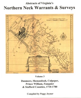
 NORTHERN NECK (LAND) WARRANTS & SURVEYS, 1710-1780: DUNMORE, SHENANDOAH, CULPEPER, PRINCE WILLIAM, FAUQUIER & STAFFORD COUNTIES by Peggy Shomo Joyner.
1986, xx, 197 pp., map, illust. Published as the third volume in a series of Northern Neck Warrants & Surveys, this collection has become a standard reference work for researchers in the period of colonial Virginia history for this area.
NORTHERN NECK (LAND) WARRANTS & SURVEYS, 1710-1780: DUNMORE, SHENANDOAH, CULPEPER, PRINCE WILLIAM, FAUQUIER & STAFFORD COUNTIES by Peggy Shomo Joyner.
1986, xx, 197 pp., map, illust. Published as the third volume in a series of Northern Neck Warrants & Surveys, this collection has become a standard reference work for researchers in the period of colonial Virginia history for this area.
Contents:
Dunmore (pp. 1-26); Shenandoah (pp. 27-40); Culpeper (pp.41-88); Prince William (pp.89-135); Fauquier (pp.137-144); Stafford (pp.145-174); George Washington surveys (pp.175-176); index.
The Northern Neck Proprietary, also called the Fairfax Proprietary, or Fairfax Grant, was a land grant first created by the exiled English King Charles II in 1649 and encompassing all the lands bounded by the Potomac and Rappahannock Rivers in colonial Virginia. This constituted up to 5,200,000 acres of Virginia's Northern Neck and a vast area northwest of it.
The grant became actual in 1660 when Charles was restored to the English throne. By 1719, these lands had been inherited by Thomas Fairfax, 6th Lord Fairfax of Cameron (1693-1781). By that time the question of the boundaries of the designated lands had also become highly contentious. It was decided in 1746 that a line between the sources of the North Branch of the Potomac and the Rappahannock River (the "Fairfax Line") would constitute the western limit of Lord Fairfax's lands. The early 17th century decade was witnessing a wave of pioneer settlement throughout the region.
To obtain land a person purchased a warrant from the proprietor's agent specifying the precise location of the desired land. The warrant was then given to a surveyor, who surveyed the land. The plat, warrant, and any related papers were returned to the proprietor's office, and if the title was clear, a grant was recorded and then issued. At any point after the warrant was purchased the land could be assigned (sold) to another person, and years could elapse between the purchase of the warrant and the issuance of a grant.
The volume is arranged first by county, then alphabetic by grantee. Please note: The index provided at the end of the volume contains only those persons whose reference occurs outside the alphabetic listing in the volume. It is NOT a complete index of names or places.
[NNW3] $27.00 (printed version)
The above title is also available as a digital e-book in PDF format:
[ENNW3] $20.00 (electronic version)
For more records pertaining to CULPEPER
COUNTY, VIRGINIA see also:


 Culpeper County was formed on 17 May 1749 from the northern part of Orange County. The new western county was named for Lord Culpeper, Governor of Virginia, 1677-1683. In 1793 Madison County was created from Culpeper's western lands, and in 1833 Rappahannock County was split off from Culpeper's northern holdings. Culpeper's boundaries stabilized at that time.
Most of Culpeper's records are intact. the only notable omissions are a few deed and will books, and the order or minute books prior to the 1790s.
Culpeper County was formed on 17 May 1749 from the northern part of Orange County. The new western county was named for Lord Culpeper, Governor of Virginia, 1677-1683. In 1793 Madison County was created from Culpeper's western lands, and in 1833 Rappahannock County was split off from Culpeper's northern holdings. Culpeper's boundaries stabilized at that time.
Most of Culpeper's records are intact. the only notable omissions are a few deed and will books, and the order or minute books prior to the 1790s.
 THE FAIRFAX LINE
 CULPEPER COUNTY, VA FEDERAL CENSUS OF 1810
Transcribed from the original by John Vogt. 2008, 8 x 10, viii, 41 pages, figure, map.This is the first surviving census for this important Piedmont Virginia county.
CULPEPER COUNTY, VA FEDERAL CENSUS OF 1810
Transcribed from the original by John Vogt. 2008, 8 x 10, viii, 41 pages, figure, map.This is the first surviving census for this important Piedmont Virginia county. Culpeper Co. 1815 Directory of Landowners
by Roger G. Ward. 2005. 37 pages, map, 5 1/2X8 1/2.
Culpeper Co. 1815 Directory of Landowners
by Roger G. Ward. 2005. 37 pages, map, 5 1/2X8 1/2.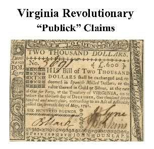 Culpeper Co. Revolutionary Public Claims
transcribed by Janice L. Abercrombie and Richard Slatten.. 2005. 82 pages, 5 1/2X8 1/2.
Culpeper Co. Revolutionary Public Claims
transcribed by Janice L. Abercrombie and Richard Slatten.. 2005. 82 pages, 5 1/2X8 1/2.