 WOLF HUNTERS ON THE VIRGINIA FRONTIER, 1776-1818 [bounty lists & certificates from Amherst, Augusta, Bath, Botetourt, Grayson, Greenbrier, Hampshire, Hardy, Mopntgomery, Patrick, Pendleton, Rockbridge, Russell, Shenandoah, Washington, and Wythe counties [dates vary] transcribed & edited by Karen Wagner Treacy. 8 1/2 x 11, vi, 169 pages, full name index.
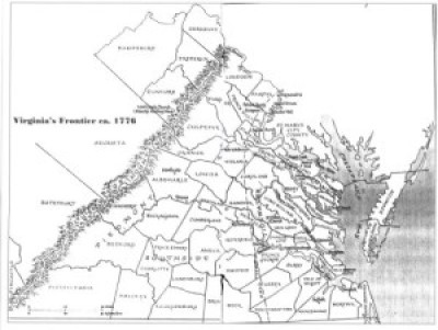
Locating an ancestor on the Virginia frontier in the late colonial and early republican period can be a daunting task. As the historian and archivist Robert Clay once remarked in a lecture, an individual he was researching in Virginia’s frontier region "appeared in a random document one morning, fully grown, and disappeared the following morning never to be heard from again.”
Oftentimes, early frontiersmen created few records and left little trace of their passing. Nowhere is this more evident than in the rapidly changing frontier west of the Blue Ridge. Starting with a trickle of settlers, there probably were no more than 160 families residing west of the mountains by 1735. By 1776 and the American Revolution, the number of settlers had grown to tens of thousands, attracted by the rich soils and pasture lands of the Shenandoah Valley and beyond, into Kentucky.
As the new government sought to bring order to the region, parent counties like Augusta and Lunenburg, which originally were little more than artificial lines when first drawn by surveyors in the wilderness, underwent division and subdivision into smaller political units to accomodate the new settlers. The trio of counties on Virginia’s frontier in the early 1740s [Frederick, Augusta, Lunenburg] would be divided and further subdivided over the next seven decades into more than sixty political units.
Author Karen Treacy has discovered an enlightening and unexpected record in the bounty system for wolf hunters. Early farmers and herders sought legislative relief from the scourge of wolf packs. The Virginia legislature responded by establishing the bounty system. In a time when an average laborer’s earning was $6-10/month, the $1 to $6 or 100# tobacco from a wolf scalp (depending on the currency and inflation of the time) was an attractive economic draw for every class of frontiersman, even those constantly moving folk mentioned by Clay.
This book is an important record not only for the two and a half thousand individuals cited but also for a valuable historical window into the activities and growth of Virginia’s frontier society.
To view a digital copy (pdf) of the index to this book, visit Index-Bounty Lists
(Close the pdf file with the left arrow to return to Iberian's catalog)
[WOLF] $34.95
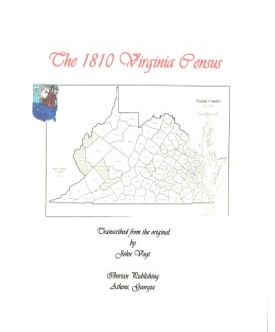 Hampshire County,Virginia 1810 Federal Census: A Transcription with index
John Vogt, 2010, x, 43 pp., 8x10 format, illustrations, maps, full name index. A faithful and accurate transcription of the first surviving census for this Virginia county.
To view a digital copy (pdf) of the index to this book, visit Index-1810-Hamp
(Close the pdf file with the left arrow to return to Iberian's catalog)
[Hamp10] $11.00 (printed version)
The above title is also available as a digital e-book in PDF format:
[EHamp10] $8.00 (electronic version)
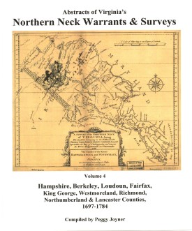 ABSTRACTS OF VIRGINIA's NORTHERN NECK (LAND) WARRANTS & SURVEYS, 1697-1784 (HAMPSHIRE, BERKELEY, LOUDOUN, FAIRFAX, KING GEORGE, WESTMORELAND, RICHMOND, NORTHUMBERLAND AND LANCASTER COUNTIES) by Peggy Shomo Joyner.
1987, xv, 225 pp. Published as the fourth and last volume in a series of Northern Neck Warrants & Surveys, this collection has become a standard reference work for researchers in the period of colonial Virginia history.
ABSTRACTS OF VIRGINIA's NORTHERN NECK (LAND) WARRANTS & SURVEYS, 1697-1784 (HAMPSHIRE, BERKELEY, LOUDOUN, FAIRFAX, KING GEORGE, WESTMORELAND, RICHMOND, NORTHUMBERLAND AND LANCASTER COUNTIES) by Peggy Shomo Joyner.
1987, xv, 225 pp. Published as the fourth and last volume in a series of Northern Neck Warrants & Surveys, this collection has become a standard reference work for researchers in the period of colonial Virginia history.
Contents:
Hampshire, 1750-1784 (pp. 1-78); Berkeley (1734), 1750-1781 (pp. 79-96); Loudoun, (1729), 1744-1779 (pp. 97-104); Fairfax, (1697), 1739-1779 (pp. 105-120); King George, (1667), 1722-1770 (pp. 121-127); Westmoreland, (1650), 1722-1778 (pp. 129-134); Richmond, (1662), 1697-1778 (pp. 135-140); Northumberland, (1653), 1719-1750 (pp. 141-142); Lancaster, (1664), 1723-1756 (p. 143); Guy Broadwater Surveys, 1749 (pp. 145-150);
Miscellaneous Wills from Land Office Records, 1656-1840 (pp. 151-160); Jonathan Clark Notebook (Improvements in the Northern Neck), 1786 (pp. 161-186); Placename index, name index.
The Northern Neck Proprietary, also called the Fairfax Proprietary, or Fairfax Grant, was a land grant first created by the exiled English King Charles II in 1649 and encompassing all the lands bounded by the Potomac and Rappahannock Rivers in colonial Virginia. This constituted up to 5,200,000 acres of Virginia's Northern Neck and a vast area northwest of it.
The grant became actual in 1660 when Charles was restored to the English throne. By 1719, these lands had been inherited by Thomas Fairfax, 6th Lord Fairfax of Cameron (1693-1781). By that time the question of the boundaries of the designated lands had also become highly contentious. It was decided in 1746 that a line between the sources of the North Branch of the Potomac and the Rappahannock River (the "Fairfax Line") would constitute the western limit of Lord Fairfax's lands. The early 17th century decade was witnessing a wave of pioneer settlement throughout the region.
To obtain land a person purchased a warrant from the proprietor's agent specifying the precise location of the desired land. The warrant was then given to a surveyor, who surveyed the land. The plat, warrant, and any related papers were returned to the proprietor's office, and if the title was clear, a grant was recorded and then issued. At any point after the warrant was purchased the land could be assigned (sold) to another person, and years could elapse between the purchase of the warrant and the issuance of a grant.
The volume is arranged first by county, then alphabetic by grantee. Please note: The index provided at the end of the volume contains only those persons whose reference occurs outside the alphabetic listing in the volume. It is NOT a complete index of names or places.
Surname list
[Nnw4] $27.00
The above title is also available as a digital e-book in PDF format:
[ENNW4] $20.00 electronic version; please note: this is a large .pdf file and will be sent as a .zip file.
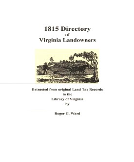 Hampshire Co. 1815 Directory of Landowners
by Roger G. Ward. 2005. 58 pages, map, 5 1/2X8 1/2.
Hampshire Co. 1815 Directory of Landowners
by Roger G. Ward. 2005. 58 pages, map, 5 1/2X8 1/2.
For a full description of the 1815 LAND DIRECTORY Records and a listing of available counties, see:
Individual County Booklets, 1815 Directory of Virginia Landowners
[Vd37] $11.00
The above title is also available as a digital e-book in PDF format:
[EVd37] $8.00 (electronic version)
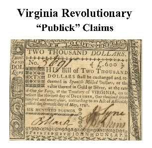 Hampshire Co. Revolutionary Public Claims
transcribed by Janice L. Abercrombie and Richard Slatten.. 2005. 37 pages, 5 1/2X8 1/2.
Hampshire Co. Revolutionary Public Claims
transcribed by Janice L. Abercrombie and Richard Slatten.. 2005. 37 pages, 5 1/2X8 1/2.
For a full description of the Virginia Revolutionary Public Claims and a listing of available counties, see:
Revolutionary "Publick" Claims series
To view a digital copy (pdf) of the index to this book, visit Index-Hamp
(Close the pdf file with the left arrow to return to Iberian's catalog)
[Pc30] $6.00 (printed version)
The above title is also available as a digital e-book in PDF format:
[EPc30] $3.50 (electronic version)
For records pertaining to Hampshire COUNTY, VIRGINIA see:


Please see our HELP PAGE for mail-order instructions, wholesaler policies and other contact information.
|| Virginia/W.Va. || General Reference || Military Records ||
|| Other States || E-Books || New Titles || Home Page || E-Books ||
Copyright 2026 Iberian Publishing Company


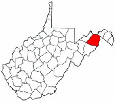 Settlers had come to the region of the future county about 1735 and by 1740 there already were small settlements along the south branch of the Potomac. Hampshire County was formed in 1754 from parts of Augusta and Frederick counties. It is the oldest county in the present state of West Virginia and probably was named for the English shire. Although the enabling legislation for the new county dates from 1754, the border unrest of the French and Indian War delayed the formal organization of the county until 1757.
In its original configuration, the new county included the present counties of Hardy, Mineral, and Grant, and portions of Morgan and Pendleton. In 1777 Augusta gave additional lands to Hampshire. In 1785 Hardy County was created from Hampshire land, but two years later, part of Hardy was returned to Hampshire's administration. In 1820 Morgan County was formed in part from Hampshire territory. Mineral County was wholly formed from Hampshire in 1866, and Mineral received additional lands from its parent county in 1868 (Mill Creek Township). This 1868 addition was repealed in 1872 and the lines returned to their 1866 position.
Although the new county was set to convene its first court in May, 1754, the opening battles of the French and Indian War, with General Braddock's disastrous defeat the following year, delayed Hampshire's courts. Most of the populace fled eastward to Frederick County as the Indian depredations increased. It was not until 1757 that the county began to function uninterrupted. By 1762 the court had been moved from its original site at Piersall's Flats to the new neighboring town of Romney, which became the county seat.
Hampshire suffered a severe records loss during the Civil War as the courthouse was occupied by Union cavalry and used as a stable, and some of the records evacuated earlier by wagon to Frederick County for safekeeping were scattered or lost.
Settlers had come to the region of the future county about 1735 and by 1740 there already were small settlements along the south branch of the Potomac. Hampshire County was formed in 1754 from parts of Augusta and Frederick counties. It is the oldest county in the present state of West Virginia and probably was named for the English shire. Although the enabling legislation for the new county dates from 1754, the border unrest of the French and Indian War delayed the formal organization of the county until 1757.
In its original configuration, the new county included the present counties of Hardy, Mineral, and Grant, and portions of Morgan and Pendleton. In 1777 Augusta gave additional lands to Hampshire. In 1785 Hardy County was created from Hampshire land, but two years later, part of Hardy was returned to Hampshire's administration. In 1820 Morgan County was formed in part from Hampshire territory. Mineral County was wholly formed from Hampshire in 1866, and Mineral received additional lands from its parent county in 1868 (Mill Creek Township). This 1868 addition was repealed in 1872 and the lines returned to their 1866 position.
Although the new county was set to convene its first court in May, 1754, the opening battles of the French and Indian War, with General Braddock's disastrous defeat the following year, delayed Hampshire's courts. Most of the populace fled eastward to Frederick County as the Indian depredations increased. It was not until 1757 that the county began to function uninterrupted. By 1762 the court had been moved from its original site at Piersall's Flats to the new neighboring town of Romney, which became the county seat.
Hampshire suffered a severe records loss during the Civil War as the courthouse was occupied by Union cavalry and used as a stable, and some of the records evacuated earlier by wagon to Frederick County for safekeeping were scattered or lost.