


Home
Reference
Census Records
Military
African-American
Other States
New Titles
E-BOOKS
FREE SHIPPING IN USA
Iberian Publishing Company's On-Line Catalog:
The Growth of Virginia, 1634-1895:
1761-1770
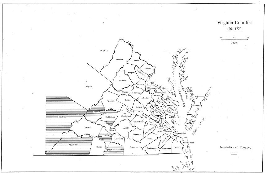
By 1761 the British had gained the upper hand in the French and Indian War (1754-1763) with the repulse of French fleets in the Channel and the reduction of Forts Louisburg and Frontenac on the Saint Lawrence, and the frontier contined to witness political change. In 1761 Albemarle gave up lands which became Amherst and Buckingham. When Pontiac's War fueled the decision by Parliament to issue the Proclamation of 1763 restricting colonial expansion past the Appalachian Divide and onto the Cumberland Plateau, new county formation turned southward.
In 1765 Charlotte and Mecklenburg were formed from Lunenburg, and in 1767 Pittsylvania was created from the western lands of Halifax. Only by the decade's end, with the relaxation of Proclamation restrictions, did westward expansion produce a new county. This was the 1770 separation of Botetourt from Augusta.
1761 - Amherst (Albemarle)
1761 - Buckingham (Albemarle)
1765 - Charlotte ((Lunenburg)
1765 - Mecklenburg (Lunenburg)
1767 - Pittsylvania (Halifax)
1770 - Botetourt (Augusta)
Go to Virginia map, 1771-1780
Return to Virginia Maps Introduction page
[adapted from Michael Doran, Atlas of County Boundary Changes in Virginia, 1634-1895], available under General References
|| Virginia/W.Va. || General Reference || Military Records ||
|| Other States || Genealogy Links || New Titles || Home Page || E-Books ||
Copyright 2026 Iberian Publishing Company
|