ship logo General Reference Guides Census Records Military Records African-American Records Other States New Titles E-Books
          Home             Reference                 Census Records       Military           African-American         Other States         New Titles           E-BOOKS     FREE SHIPPING IN USA

Iberian Publishing Company's On-Line Catalog:
Loudoun County Virginia


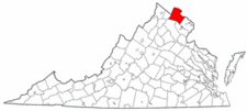
Map of Va: Loudoun CountyLoudoun County was created on 1 July 1757 from the northwestern portion of Fairfax County lying above Difficult Run. Forty years later, in 1797, a small portion of Loudoun was returned to Fairfax's jurisdiction, and at that time the county reached its present boundaries. The county was named in honor of John Campbell, fourth earl of Loudoun, titular governor of Virginia (1756-1759), and head of the British forces in America, 1756-1758, during the first years of the French and Indian conflict. The new county lay at the intersection of two major early Indian trails which later became the Leesburg Pike and the Carolina Road. On the western edge of the county, Harper's Ferry marked the beginning of the Virginia portion of the Great Valley Road. Consequently, Loudoun County became a waystation for many settlers who later moved south and west into the new lands opening in the eighteenth century.

For a better understanding of county boundary changes, see our new section Virginia in Maps
Iberian also has hundreds of titles in e book (PDF) format!! Click here for a complete online catalog of available titles
THE REGISTER OF OVERWHARTON PARISH, STAFFORD COUNTY, VIRGINIA 1723-1758 AND SUNDRY HISTORICAL AND GENEALOGICAL NOTES
by George Harrison Sanford King, xii, 1961. AVAILABLE IN ELECTRONIC (PDF) FORMAT ONLY

The county and parish take their names from the corresponding ones in England. Stafford county once extended up to the Blue Ridge Mountain. In the year 1730, Prince William county was formed from the "heads of King George and Stafford." Overwharton parish was also coextensive with Stafford before Prince William was divided and Hamilton parish taken off. In the same year,--1730,--Overwharton parish was divided and Hamilton parish taken off. Overwharton covered the narrow county of Stafford, and Hamilton the large county of Prince William before Fauquier, Fairfax, and Loudoun were taken away. Stafford, in its original dimensions, first appears as a county in 1666 when it was created from Westmoreland County. When it was erected into a parish is not known,--but most probably about the same time. Its division in 1730 is the first mention of it. The Rev. Robert Rose in his account book mentions the Rev. Alexander Scott as a minister in it in 1727

The Register of Overwharton Parish, Stafford County,.... was an update to the original 1899 publication of William F. Boogher (also available on this page [below]). It includes Births, Baptism, Marriage and Death records as recorded in their original order along with a supplemental index.

The Overwharton Register is arranged alphabetically by surnames in chronological order and these names are not carried into the general index.
To view a digital copy of the general index to this book, visit Index-Ovwp
(Close the pdf file with the left arrow to return to Iberian's catalog)
Add to Cart

[EOVWP] $18.00     (electronic version only)


OVERWHARTON PARISH, VIRGINIA REGISTER, 1720 TO 1760
by Wm. F. Boogher, 1899, xiii, 195 pages AVAILABLE IN ELECTRONIC (PDF) FORMAT ONLY

Overwharton Parish was formed in 1680 as the upper parish or Stafford Parish. The parish was co-extensive with Stafford County, covering a part of what was once Washington Parish, extending about eighty miles along the Potomac, in breadth about four and twenty miles, embracing within its territory what is now Prince William, Loudoun, Fairfax, Alexandria Counties and a part of Fauquier until 1730, when Prince William County was taken from Stafford, and Hamilton Parish was erected, succeeding Overwharton as the frontier parish. Of the early history of Overwharton Parish and its rectors, but little is known.

The entries in the parish register consist of births, marriages, and deaths and are arranged in one continuous alphabetical sequence. The marriage records take up nearly half of the register and provide the names of the bride and groom and the date of the marriage; the birth records include the name of the newborn, date of birth, and the names of parents; and the death records give the decedent by name and date of death. In all, more than 6,000 early inhabitants of Stafford County, Virginia are preserved in this valuable resource.

Add to Cart

[EOVRP] $15.00     (electronic version only)


LEGENDS OF LOUDOUN: AN ACCOUNT OF THE HISTORY AND HOMES OF A BORDER COUNTY OF VIRGINIA OF VIRGINIA'S NORTHERN NECK by Harrison Williams (original edition: Garrett and Massie [Richmond, Va, 1938]; reprnted, Iberian Publishing, 2017. 8x10, xv, 227 pages. Maps, illustrations, full name index. A class ic work which has endured for nearly a century. Reprinted several times in abbreviated fashion, the current reprint (and e book below) are taken for the original, complete 1938 edition. This work brings into focus aspects of Loudoun's history from earliest times which are not to be found in the formal county and federal records.
Loudoun was an important and populous county (more than 21,000 in 1810) in the Northern Neck and was a gateway westward during the later eighteenth and early nineteenth centuries.

To view a digital copy of the index to this book, visit Index-Lelo
(Close the pdf file with the left arrow to return to Iberian's catalog)
Add to Cart

[LELO] $26.95     (printed version)


The above title is also available as a digital e-book in PDF format:
Add to Cart

[ELELO] $18.00     (electronic version)


LOUDOUN CO., VA 1810 CENSUS transcribed by John Vogt. 10 1/2 x 8 1/2, x, 80 pages. Maps, illustrations, full name index. This is the first surviving census for Loudoun, since both the 1790 and 1800 censuses have been lost. The transcription is in the order of the original document as it was taken by Stephen Roszel, the enumerator. A full name index is procvided for easy reference. Loudoun was an important and populous county (more than 21,000 in 1810) in the Northern Neck and was a gateway westward during the later eighteenth and early nineteenth centuries.

N.B.: Numerous queries have asked why bother with printed books when these images are available online for examination. This and other 1810 censuses are transcribed by the author from the original microfilm images, and while many of Virginia's censuses are available online, they oftentimes are replete with misreadings and omissions. For example, a popular genealogical site which reproduces images (albeit very poor quality compared with the originals) has left off the last twelve folios of data from Loudoun! Caveat emptor!

To view a digital copy of the index to this book, visit Index-1810-Loud
(Close the pdf file with the left arrow to return to Iberian's catalog)
Add to Cart

[LOUD10] $17.00     (printed version)


The above title is also available as a digital e-book in PDF format:
Add to Cart

[ELOUD10] $12.00     (electronic version)


LOUDOUN COUNTY MARRIAGES, 1760-1850 John Vogt & T. William Kethley, Jr. 1985, ix, 462 pages, indices, figure, map. Loudoun County was first organized in 1757 from a portion of Fairfax County. The earliest surviving marriage record dates from 1760. A total of 4,524 marriages are abstracted in this volume and a complete index of all names is provided; the records are drawn from a variety of archival sources, including ministers' returns, bonds, consents, permissions, and notes.
To view a digital copy of the index to this book, visit Index-Loud
(Close the pdf file with the left arrow to return to Iberian's catalog)
Add to Cart

[Loud] $32.00     (printed version)


The above title is also available as a digital e-book in PDF format:
Add to Cart

[ELOUD] $20.00     (electronic version)


LOUDOUN COUNTY MILITIA REGISTERS, 1793-1829 by Don Blincoe, Sr. 1993, ix, 495 pages (81/2x11), indices. A careful and exact transcription of the militia registers for this most important county. Contains over 20,000 references to men who served during this period. Extremely valuable, since every able-bodied male over sixteen years was liable for service unless exempted by age or infirmity. Also important for families who moved away, since often in the registers it notes their destinations. The Loudoun County militia journals list the names of hundreds of men who lived there from 1793 until 1824. There are company rosters naming the officers, sergeants, corporals, drummers and clerks. Officers of higher rank and assignment are frequently mentioned. One can also find the names and locations of home and tavern owners who provided space for companies to muster and rooms for boards to convene in. Although there is little family information, some militiamen are further identified by the listing of their fathers' or masters' names beside their own. There are many rosters which include father and son or several brothers, all in the same companies.
To view a digital copy of the index to this book, visit Index-Lomp
(Close the pdf file with the left arrow to return to Iberian's catalog)
Add to Cart

[Lomp] $41.95     (printed version)


The above title is also available as a digital e-book in PDF format:
Add to Cart

[ELOMP] $30.00     (electronic version)


LOUDOUN COUNTY, VIRGINIA TITHABLES, 1758-1786 by Marty Hiatt & Craig Roberts Scott. 1994,2011. 3 volumes, 1568 pages (81/2 x 11), index. A full and faithful transcription of the tithable records of this most important Northern Neck County. A must for any eighteenth-century researcher in the Northern Neck area.
To view a digital copy of the index to volume 1 of this book, visit Index-Ldtt-v1
N.B: each index contains the names of slaveowners, with their slaves' names, followed by a general index
(Close the pdf file with the left arrow to return to Iberian's catalog)

To view a digital copy of the index to volume 2 of this book, visit Index-Ldtt-v2
N.B: each index contains the names of slaveowners, with their slaves' names, followed by a general index
(Close the pdf file with the left arrow to return to Iberian's catalog)

To view a digital copy of the index to volume 3 of this book, visit Index-Ldtt-v3
N.B: each index contains the names of slaveowners, with their slaves' names, followed by a general index
(Close the pdf file with the left arrow to return to Iberian's catalog)
Add to Cart

[Ldtt] soft cover, 3v. set, 81/2x11 $56.95     (printed version)


The above title is also available as a digital e-book in PDF format:
Add to Cart

[ELDTT] $40.00     electronic version


INDEX TO THE LOUDOUN COUNTY, VIRGINIA CHANCERY SUITS, 1759-1915 by Marty Hiatt & Craig Roberts Scott. 1994, 206 pages (81/2x11). An index of the chancery suits arranged alphabetical both by plaintiff and defendant.
Add to Cart

[Ldcs] $32.00     (printed version)


The above title is also available as a digital e-book in PDF format:
Add to Cart

[ELDCS] $20.00     electronic version


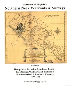
ABSTRACTS OF VIRGINIA's NORTHERN NECK (LAND) WARRANTS & SURVEYS, 1697-1784 (HAMPSHIRE, BERKELEY, LOUDOUN, FAIRFAX, KING GEORGE, WESTMORELAND, RICHMOND, NORTHUMBERLAND AND LANCASTER COUNTIES) by Peggy Shomo Joyner. 1987, xv, 225 pp. Published as the fourth and last volume in a series of Northern Neck Warrants & Surveys, this collection has become a standard reference work for researchers in the period of colonial Virginia history.
Contents:
Hampshire, 1750-1784 (pp. 1-78); Berkeley (1734), 1750-1781 (pp. 79-96); Loudoun, (1729), 1744-1779 (pp. 97-104); Fairfax, (1697), 1739-1779 (pp. 105-120); King George, (1667), 1722-1770 (pp. 121-127); Westmoreland, (1650), 1722-1778 (pp. 129-134); Richmond, (1662), 1697-1778 (pp. 135-140); Northumberland, (1653), 1719-1750 (pp. 141-142); Lancaster, (1664), 1723-1756 (p. 143); Guy Broadwater Surveys, 1749 (pp. 145-150); Miscellaneous Wills from Land Office Records, 1656-1840 (pp. 151-160); Jonathan Clark Notebook (Improvements in the Northern Neck), 1786 (pp. 161-186); Placename index, name index.

The Northern Neck Proprietary, also called the Fairfax Proprietary, or Fairfax Grant, was a land grant first created by the exiled English King Charles II in 1649 and encompassing all the lands bounded by the Potomac and Rappahannock Rivers in colonial Virginia. This constituted up to 5,200,000 acres of Virginia's Northern Neck and a vast area northwest of it.

The grant became actual in 1660 when Charles was restored to the English throne. By 1719, these lands had been inherited by Thomas Fairfax, 6th Lord Fairfax of Cameron (1693-1781). By that time the question of the boundaries of the designated lands had also become highly contentious. It was decided in 1746 that a line between the sources of the North Branch of the Potomac and the Rappahannock River (the "Fairfax Line") would constitute the western limit of Lord Fairfax's lands. The early 17th century decade was witnessing a wave of pioneer settlement throughout the region.

To obtain land a person purchased a warrant from the proprietor's agent specifying the precise location of the desired land. The warrant was then given to a surveyor, who surveyed the land. The plat, warrant, and any related papers were returned to the proprietor's office, and if the title was clear, a grant was recorded and then issued. At any point after the warrant was purchased the land could be assigned (sold) to another person, and years could elapse between the purchase of the warrant and the issuance of a grant.

The volume is arranged first by county, then alphabetic by grantee. Please note: The index provided at the end of the volume contains only those persons whose reference occurs outside the alphabetic listing in the volume. It is NOT a complete index of names or places.

Surname list

Add to Cart

[Nnw4] $27.00     (printed version)


The above title is also available as a digital e-book in PDF format:
Add to Cart

[ENNW4] $20.00     (electronic version)


Loudoun Co. 1815 Directory of Landowners by Roger G. Ward. 2005. 47 pages, map, 5 1/2X8 1/2.
For a full description of the 1815 LAND DIRECTORY Records and a listing of available counties, see combined volume below
Add to Cart

[Vd59] $10.00     (printed version)


The above title is also available as a digital e-book in PDF format:
Add to Cart

[EVd59] $7.00     (electronic version)


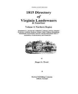
1815 DIRECTORY OF VIRGINIA LANDOWNERS & GAZETTEER, vol. 4 Northern Region (Includes the counties and cities of Alexandria (i.e., present-day Arlington), Culpeper, Fairfax, Fauquier, Frederick, Loudoun, Madison, Orange, Prince William, Rockingham, Shenandoah, Spotsylvania, Stafford, and the independent cities of Alexandria, Fredericksburg, and Winchester ) abstracted by Roger G. Ward. 1997, vi, 220 pages, indices, maps.
In 1782 the General Assembly of Virginia enacted new tax laws which created within each county an enumeration of land and certain personal property. These early land tax laws required a tax commissioner in each district of a county to record a list of the names of persons owning land or town lots, the quantity of land owned and its value, and the amount of tax owed. By 1813, a brief geographic description (usually citing an adjacent stream, road, or other landmark) was required; in 1814, the distance and direction from the courthouse for each parcel was also added to the tax rolls.
The present work is an alphabetical listing of all 1815 landowners found in each county, as well as the accompanying description of the location of the said property. We have not included the number of acres, taxes assessed, or any transactions between landowners which may have been noted on the tax rolls; also, in many cases the geographic location was provided as "adjacent to John Smith", etc. and, while useful many times to a genealogist, was considered to be beyond the objectives of this project. The reader is encouraged to consider the information here-in as an "outline" of early landowners in Virginia rather than a "text" due to the year-to-year variation in information provided to the clerk (or recorded by the clerk), omissions, lack of "identifiers" to determine if "same name" was also "same person" within a district or across districts, marginal quality/clarity (in a few cases) of the microfilm copy, and, not least, errors on the part of either the original clerks or the current author while transcribing.
Some of the approaches to utilizing the 1815 landowner information include:
  1. observe distinct clusters of the same surname within a county in order to clarify the common surnames such as "Smith", "Anderson", etc;
  2. identify non-resident landowners and their county (or state) of residence (these people often being former residents of the current county);
  3. determine neighbors with different surnames (often being relatives);
  4. use the 1815 information as a "bridge" from the 18th and 19th century deed/will books to the 17th and 18th century land grants/patents in the county;
  5. evaluate the 1810 to 1840 census information which generally grouped neighbors;
  6. substitute this information for missing deed/will books in the "burned" counties; and, clarify/enhance vague deed/will information in the counties with more complete records.
FORMAT OF PRESENTATION: Each entry is listed as: Surname, name, personal identifiers (if any); location/place-name of land; miles/direction from the 1815 courthouse. If multiple owners are listed for a property, the listing is duplicated under each of the owner's surnames (i.e "Smith and Brown" is also listed as "Brown, --see Smith"); when multiple owners share a common surname, the property is only listed once. When a landowner had land at more than one location/place-name, the miles/direction listing for each parcel is in the same sequence as the location listing (i.e. James RV, Slate CK; 12N, 5SW.). In the few cases where a landowner had "many" parcels, the miles/direction notation is attached to the location listing (i.e. Sandy RV- 5NE, Willow CK-7S, etc.)

Add to Cart

[Vdl4] $32.00    (paper version)


The above title is also available as a digital e-book in PDF format:
Add to Cart

[EVDL-4] $20.00     (electronic version)


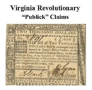
Loudoun Co. Revolutionary Public Claims transcribed by Janice L. Abercrombie and Richard Slatten.. 2005. 64 pages, 5 1/2X8 1/2.
For a full description of the Virginia Revolutionary Public Claims and a listing of available counties, see:
Revolutionary "Publick" Claims series


To view a digital copy (pdf) of the index to this book, visit Index-Loud
(Close the pdf file with the left arrow to return to Iberian's catalog)
Add to Cart

[Pc40] $8.75     (printed version)


The above title is also available as a digital e-book in PDF format:

Add to Cart

[EPc40] $6.00     (electronic version)


For more records pertaining to LOUDOUN COUNTY, VIRGINIA see also:

Please see our HELP PAGE for mail-order instructions, wholesaler policies and other contact information.


|| Virginia/W.Va. || General Reference || Military Records ||
|| Other States || E-Books || New Titles
|| Home Page || E-Books ||

Copyright 2026 Iberian Publishing Company