ship logo General Reference Guides Census Records Military Records African-American Records Other States New Titles E-Books
          Home             Reference                 Census Records       Military           African-American         Other States         New Titles           E-BOOKS     FREE SHIPPING IN USA

Iberian Publishing Company's On-Line Catalog:
Goochland County Virginia


Map of Va: Goochland CountyGoochland County was formed in 1728 from the western portion of Henrico County. The name was given the new county in honor of the recently-arrived Lieutenant Governor of Virginia, William Gooch (1727-1749). At the time of its creation, Goochland's lands stretched to include all or part of the present counties of Amherst, Appomattox, Albemarle, Bedford, Buckingham, Campbell, Cumberland, Fluvanna, Nelson, and Powhatan. In 1744 the western portion of Goochland was detached to form Albemarle County, and in 1749 Cumberland County was created out of Goochland's lands south of the James River. With the settling of the line between Fluvanna and Goochland in 1785, the latter's boundaries were stabilized. As the lower James River settlements began to grow in the seventeenth century, many of the frontier farmers began to settle along the James north of the falls at Henrico. The land was fertile, although it required land transport to reach the deepwater wharves below the falls. During the last quarter of the seventeenth century population slowly began to grow in this region. then, in 1700 a massive infusion of settlers came with the migration ofa large number of French Huguenots, fleeing from persecution. they were settled as a group at "Manakintowne" on the eastern corner of what later came to be Goochland County. Population grew quickly throughout the new county during the eighteenth century, and many of its settlers went westward into Albemarle, Fluvanna, and Buckingham Counties. The records for Goochland are mostly complete, except for a few county order books which were vandalized by Union soldiers in the Civil War.
For a better understanding of county boundary changes, see our new section Virginia in Maps
Iberian also has hundreds of titles in e book (PDF) format!! Click here for a complete online catalog of available titles
GOOCHLAND CO., VA 1810 CENSUS transcribed by John Vogt. 10 1/2 x 8 1/2, x, 19 pages, maps, illus. This is the first surviving census for Gloucester, since both the 1790 and 1800 censuses have been lost. The transcription is in its original rough alpha order of the original document for easy reference.
Add to Cart

[GC10] $8.95     (printed version)


The above title is also available as a digital e-book in PDF format:
Add to Cart

[EGC10] $5.00     (electronic version)


THE REGISTER OF ST. JAMES NORTHAM PARISH, GOOCHLAND COUNTY, VIRGINIA
extracted from the William and Mary Quarterly, vol. 15 [1906-1907], ii. 30 pgs.

The following register was published in serial form by the William and Mary Quarterly in 1906-07. It was a portion of the Douglas Register which had been recently secured from the Douglas family.

In 1720, there were two parishes in Henrico County, St. James and Henrico. When Goochland County was formed, St. James Parish fell within the boundaries on both sides of the James River and westward. When Albemarle County was formed from Goochland in 1744, the Parish was divided into three. St. Anne's Parish covered Albemarle, St. James Southam Parish covered the south side of the river (now Powhatan County), and St. James Northam Parish covered the rest of Goochland.

In its original form, Goochland contained the modern counties of Goochland, Powhatan, Cumberland, Fluvanna, Buckingham, Nelson, and Amherst, in their entireties. In addition, the northern sections of Appomattox, Campbell, and Bedford, and the southern two-thirds of Albemarle County were also within Goochland's original boundaries. The creation of Albemarle County in 1744 and Cumberland County in 1749 removed most of Goochland's southern and western territory, reducing it to its modern size and boundaries.

In St. James Northam Parish there were three early churches, all Anglican (and Episcopal after the church was disestablished after the Revolution): Dover, Beaverdam, and Lickinghole. Dover was the first, being built in 1724; it closed sometime after the Revolutionary War. Its location and closing date are unknown.

Among the earliest European settlers in this area of the Piedmont were several hundred French Huguenot religious refugees, who were given land in 1700 and 1701 by the Crown and colonial authorities about 20 miles above the falls of the James River. They settled the villages collectively known as Manakin-Sabot in this area. Soon they moved out to farms and plantations they developed. In neighboring Powhatan County, to the south across the James, they settled Manakin Town, but by 1750 had mostly moved out to farms.

To facilitate researchers, the digital version has been arranged in a fully searchable fashion using the "Find" function.

Add to Cart

[Sjnp] $10.00


The above title is also available as a digital e-book in PDF format:
Add to Cart

[ESJNP] $7.00     (electronic version)


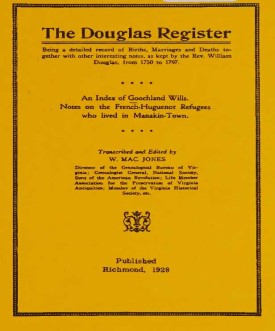
THE DOUGLAS REGISTER, Being a detailed record of Births, Marriages and Deaths together with other interesting notes, as kept by the Reverend William Douglas, from 1750 to 1797 [With an Index of Goochland Wills and Notes on the French Huguenot Refugees who Lived in Manakin-Town].
Richmond, Va., 1928 edition, vi, 408 pages AVAILABLE IN ELECTRONIC (PDF) FORMAT ONLY

The celebrated Douglas Register is an indispensable compilation of births, marriages, and deaths covering the period from about 1750 to 1797, with some miscellaneous records going back to 1705. The registers are for the parishes of St. James Northam (Dover Church) and King William, but they concern individuals who were residents of the Virginia counties of Fluvanna, Goochland, Louisa, Orange, and Spotsylvania. Entries under the headings of births, marriages, and deaths are arranged alphabetically, with marriages divided into separate lists for husbands and wives. The entries exceed several thousand in number. The book also includeslists of Huguenot settlers at Manakin-Town (King William Parish) and an index of Goochland County wills, 1728-1840, containing about 1,000 names with references to dates and locations.

Add to Cart

[EDREG] $18.00     (electronic version only


ST. JAMES NORTHAM PARISH VESTRY BOOK, 1744-1850 by William Lindsay Hopkins, 1987. 129 pages, index. This current volume contains all of the parish vestry business including the important "processioning of lands" which took place every four years and many times names the land owners and the men who were doing the processioning. A wonderful collection of data on early Goochland County society.
To view a digital copy of the index to this book, visit Index-Stjm
(Use your back arrow to return to Iberian's catalog)
Add to Cart

[Stjm] $20.00


The above title is also available as a digital e-book in PDF format:
Add to Cart

[ESTJM] $15.00     (electronic version)


GOOCHLAND CO., VIRGINIA, WILLS & DEEDS, 1728-1736 by Benjamin B. Weisiger, III, 1983. 105 pages, index. Goochland County was formed in 1727 from the western portion of Henrico County. At the time of its creation, Goochland's lands stretched to include all or part of the present counties of Amherst, Appomattox, Albemarle, Bedford, Buckingham, Campbell, Cumberland, Fluvanna, Nelson, and Powhatan. In 1744 the western portion of Goochland was detached to form Albemarle County, and in 1749 Cumberland County was created out of Goochland's lands south of the James River. With the setting of the line between Fluvanna and Goochland in 1785, the latter's boundaries were stabilized. The current volume contains will and deed records from the time of its formation for the better part of the first decade of its existence as a Virginia county.
To view a digital copy of the index to this book, visit Index-Gch1
(Use your back arrow to return to Iberian's catalog)
Add to Cart

[Gch1] $17.00     (printed version)


The above title is also available as a digital e-book in PDF format:
Add to Cart

[EGCH1] $10.00     (electronic version)


GOOCHLAND COUNTY, VIRGINIA, WILLS & DEEDS, 1736-1742 by Benjamin B. Weisiger, III, 1984. 76 pages, index. As above.
To view a digital copy of the index to this book, visit Index-Gch2
(Use your back arrow to return to Iberian's catalog)
Add to Cart

[Gch2] $14.95     (printed version)


The above title is also available as a digital e-book in PDF format:
Add to Cart

[EGCH2] $9.00     (electronic version)


GOOCHLAND COUNTY, VIRGINIA, WILLS, 1742-1749 by Benjamin B. Weisiger, III, 1984. 88 pages, index. Wills and a list of grantors and grantees of deeds.
To view a digital copy of the index to this book, visit Index-Gch3
(Use your back arrow to return to Iberian's catalog)
Add to Cart

[Gch3] $14.95     (printed version)


The above title is also available as a digital e-book in PDF format:
Add to Cart

[EGCH3] $9.00     (printed version)


COHABITATION LISTS OF FORMER SLAVES IN GOOCHLAND, HANOVER, AND LOUISA COUNTIES, VIRGINIA, AS RECORDED BY THE FREEDMEN'S BUREAU Transcribed by Janice Abercrombie, 2002, 8"x11" format, 140 pages, index.In February, 1866 the General Assembly passed an act that called for the registration of marriages of former slaves who wished to have their unions recorded This fell under the jurisdiction of the Freedmen's Bureau. These lists provide an unparalleled window into the patterns of slave marriages. For example, in the Hanover list, in addition to the ages and full names of husband and wife, it records the date and place of marriage, the couple's places of birth and residence, marital status (single or widowed), and husband's occupation. The Goochland and Louisa lists record similar date in most cases.
To view a digital copy of the index to this book, visit Index-Gchl
(Close the pdf file with the left arrow to return to Iberian's catalog)
Add to Cart

[Gchl] $26.95     (printed version)


The above title is also available as a digital e-book in PDF format:
Add to Cart

[EGCHL] $15.00     (electronic version)


Goochland Co. 1815 Directory of Landowners by Roger G. Ward. 2005. 22 pages, map, 5 1/2X8 1/2.
For a full description of the 1815 LAND DIRECTORY Records and a listing of available counties, see combined volume below
Add to Cart

[Vd32] $7.00     (printed version)


The above title is also available as a digital e-book in PDF format:
Add to Cart

[EVd32] $4.50     (electronic version)


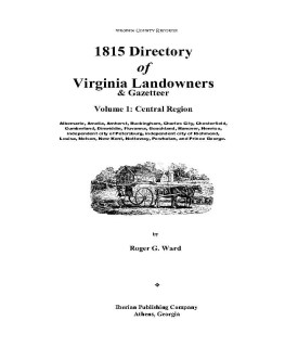
1815 DIRECTORY OF VIRGINIA LANDOWNERS & GAZETTEER, vol. 1 Central Region (Includes the counties of Albemarle, Amelia, Amherst, Buckingham, Charles City, Chesterfield, Cumberland, Dinwiddie, Fluvanna, Goochland, Hanover, Henrico, independent city of Petersburg, independent city of Richmond, Louisa, Nelson, New Kent, Nottoway, Powhatan, and Prince George.) abstracted by Roger G. Ward. 1997, vi, 239 pages, indices, maps.
In 1782 the General Assembly of Virginia enacted new tax laws which created within each county an enumeration of land and certain personal property. These early land tax laws required a tax commissioner in each district of a county to record a list of the names of persons owning land or town lots, the quantity of land owned and its value, and the amount of tax owed. By 1813, a brief geographic description (usually citing an adjacent stream, road, or other landmark) was required; in 1814, the distance and direction from the courthouse for each parcel was also added to the tax rolls.
The present work is an alphabetical listing of all 1815 landowners found in each county, as well as the accompanying description of the location of the said property. We have not included the number of acres, taxes assessed, or any transactions between landowners which may have been noted on the tax rolls; also, in many cases the geographic location was provided as "adjacent to John Smith", etc. and, while useful many times to a genealogist, was considered to be beyond the objectives of this project. The reader is encouraged to consider the information here-in as an "outline" of early landowners in Virginia rather than a "text" due to the year-to-year variation in information provided to the clerk (or recorded by the clerk), omissions, lack of "identifiers" to determine if "same name" was also "same person" within a district or across districts, marginal quality/clarity (in a few cases) of the microfilm copy, and, not least, errors on the part of either the original clerks or the current author while transcribing.
Some of the approaches to utilizing the 1815 landowner information include:
  1. observe distinct clusters of the same surname within a county in order to clarify the common surnames such as "Smith", "Anderson", etc;
  2. identify non-resident landowners and their county (or state) of residence (these people often being former residents of the current county);
  3. determine neighbors with different surnames (often being relatives);
  4. use the 1815 information as a "bridge" from the 18th and 19th century deed/will books to the 17th and 18th century land grants/patents in the county;
  5. evaluate the 1810 to 1840 census information which generally grouped neighbors;
  6. substitute this information for missing deed/will books in the "burned" counties; and, clarify/enhance vague deed/will information in the counties with more complete records.
FORMAT OF PRESENTATION: Each entry is listed as: Surname, name, personal identifiers (if any); location/place-name of land; miles/direction from the 1815 courthouse. If multiple owners are listed for a property, the listing is duplicated under each of the owner's surnames (i.e "Smith and Brown" is also listed as "Brown, --see Smith"); when multiple owners share a common surname, the property is only listed once. When a landowner had land at more than one location/place-name, the miles/direction listing for each parcel is in the same sequence as the location listing (i.e. James RV, Slate CK; 12N, 5SW.). In the few cases where a landowner had "many" parcels, the miles/direction notation is attached to the location listing (i.e. Sandy RV- 5NE, Willow CK-7S, etc.)

Add to Cart

[Vdl1] $32.00    (paper version)


The above title is also available as a digital e-book in PDF format:
Add to Cart

[EVDL-1] $20.00     (electronic version)


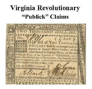
Goochland Co. Revolutionary Public Claims transcribed by Janice L. Abercrombie and Richard Slatten. 2005. 52 pages, 5 1/2X8 1/2.
For a full description of the Virginia Revolutionary Public Claims and a listing of available counties, see:
Revolutionary "Publick" Claims series
To view a digital copy (pdf) of the index to this book, visit Index-Gooc
(Close the pdf file with the left arrow to return to Iberian's catalog)
Add to Cart

[Pc26] $7.75     (printed version)


The above title is also available as a digital e-book in PDF format:

Add to Cart

[EPc26] $5.00     (electronic version)


For more records pertaining to GOOCHLAND COUNTY, VIRGINIA see also:


Please see our HELP PAGE for mail-order instructions, wholesaler policies and other contact information.

|| Virginia/W.Va. || General Reference || Military Records ||
|| Other States || E-Books || New Titles
|| Home Page || E-Books ||

Copyright 2026 Iberian Publishing Company