ship logo General Reference Guides Census Records Military Records African-American Records Other States New Titles E-Books
          Home             Reference                 Census Records       Military           African-American         Other States         New Titles           E-BOOKS     FREE SHIPPING IN USA

Iberian Publishing Company's On-Line Catalog:
Fauquier County Virginia


Map of Va: Fauquier CountySettlers began moving into the western portion of Prince William County as early as 1704. By 1759 the population had reached a size sufficient to warrant a county in its own right. Fauquier County was created on 1 May 1759 from the western lands of Prince William County. Following a tradition established by some of his predecessors, the county was named in honor of the current lieutenant governor, Francis Fauquier (1758-1768). Its boundaries have remained unchanged since that time. Fauquier County was an area held in large tracts by landowners who preferred to lease rather than sell the property to those who farmed it. Consequently, it was a county which provided many settlers for the Shenandoah Valley and beyond as the farmers preferred the cheaper western lands to the Fauquier leases. Germans from Spotswood's Germanna colony moved there in considerable numbers in 1718 when their tenure of indenturement with Spotswood had ended, and they founded Germantown. A number of Scots and Germans from Pennsylvania also came into the colony and settled for a time. Fauquier's records are nearly complete, despite two courthouse fire (1853 and 1859).

For a better understanding of county boundary changes, see our new section Virginia in Maps
Iberian also has hundreds of titles in e book (PDF) format!! Click here for a complete online catalog of available titles
Fauquier County,Virginia 1810 Federal Census: A Transcription
John Vogt, 2008, x, 57 pp., 8x10 format, illustrations, maps, full name index. A faithful and accurate transcription of the first surviving census for this Virginia county.
It includes not only the rural areas of the county, but separate listings for the communities of Buckland, Hay Market, Occoquan, and Dumfries. This work corrects many of the mistranslations currently on the Internet.

Surname list

Add to Cart

[FQ10] $17.00     (printed version)


The above title is also available as a digital e-book in PDF format:
Add to Cart

[EFQ10] $12.00     (electronic version)


HIGH IN OLD VIRGINIA'S PIEDMONT: A HISTORY OF MARSHALL (FORMERLY SALEM), FAUQUIER COUNTY, VIRGINIA by John Gott

Marshall, Virginia - renamed in 1882 in honor of Chief Justice John Marshall, has experienced many changes since the town was surveyed and platted by John Mauzy in 1797. The geographical focus of this book is based on that survey and an area of 2 1/2 miles surrounding the village.

From these early settlement beginnings to a small, pleasant town of rural charm in the early 1950s, Marshall experienced complex problems brought about by the onset of progress. Because of northern Virginia expansion to the area, anticipated future growth did not mature, townhouse development became a reality and Interstate 66 was opened through Fauquier County, placing many demands upon a small town.

Historian John Gott, by presenting this history in an honest and impartial interpretation, connects the past in some way with the conditions of the times. Problems are discussed and suggestions for solutions are explored. Optimistically, he feels there are public spirited individuals and business firms with a sense of both past and future who will devise ways of preserving the best of what remains, and use it to enhance the future to Marshall.

The current volume was first published in hardback form in extremely limited quantities in 1987, and it became an immediate classic. The current paperback edition was authorized by the author just one month prior to his death in July 2004.
2004. 8 x 10, x, 226 pages.

To view a digital copy (pdf) of the index to this book, visit Index-Hiop
(Close the pdf file with the left arrow to return to Iberian's catalog)
Add to Cart

[HIOP] $32.00     (printed version)


The above title is also available as a digital e-book in PDF format:
Add to Cart

[EHIOP] $23.00     (electronic version)


FLINT HILL FARM: A HISTORY (GEORGE WASHINGTON'S "TRACT ON
CHATTIN'S RUN", RECTORTOWN, FAUQUIER COUNTY, VIRGINIA
by John Gott


An in-depth study of one of George Washington's properties in Fauquier County, beginning with its acquisition and following the ownership up to the present day. This is a scholarly presentation, with copious notes; Washington's involvement with the property is thoroughly documented. 2004. 8 x 10, x, 128 pages.

To view a digital copy (pdf) of the index to this book, visit Index-Fhfh
(Close the pdf file with the left arrow to return to Iberian's catalog)


Add to Cart

[Fhfh] paper $27.00     (printed version)


The above title is also available as a digital e-book in PDF format:
Add to Cart

[EFHFH] $18.00     (electronic version)


FAUQUIER FAMILIES, 1759-1799: COMPREHENSIVE INDEXED ABSTRACTS OF TAX AND TITHABLE LISTS, MARRIAGE BONDS AND MINUTE, DEED AND WILL BOOKS PLUS OTHER 18TH CENTURY RECORDS OF FAUQUIER COUNTY, VIRGINIA by John P. Alcock. This book is a godsend for genealogists working on Fauquier ancestors. The abstracts summarize all significant genealogical information currently available relating to any and all persons who got into the records of county or state governments from the first session of the county court in May 1759 through the end of 1799. If one doesn't find a searched-for name in this book, chances of uncovering something useful in the courthouse in Warrenton or the State Archives in Richmond are minimal. These abstracts summarize Will Books, Deed Books, Minute (Order) Books of the County Court, Marriage Bonds and their associated consents, Tithable and Personal Property Tax Lists, colonial quitrents, rent rolls for Leeds Manor, and other records available at the county courthouse and in the Virginia State Archives. 1994. (Retypeset and Reprinted 2015) 8 x 10, xxvi, 362 pages.

The book is arranged in alphabetic order by surname and no complete index is available. However, an index of the names found out of their alphabetic arrangement is available and presented here. Be Sure to read the brief introductory paragraph at the beginning of this 'index'. To view a digital copy (pdf) of the index to this book, visit
Index-Fqfp
(Close the pdf file with the left arrow to return to Iberian's catalog)

Add to Cart

[Fqfp] paper $41.95     (printed version)


The above title is also available as a digital e-book in PDF format:
Add to Cart

[EFQFP] $30.00     (electronic version)


FAUQUIER COUNTY, VIRGINIA RECORDS Fauquier Families volume 2 (supplement) by John P. Alcock. 2000. 8 x 10, x, 212 pages.
In 1996 a large part of the "loose papers" from the basement of the Fauquier County Courthouse was sorted, catalogued, indexed, and filed systematically. Early in 1997 it was brought upstairs to the Records Room and added to the deed books, will books, marriage records, etc. This Supplement, like its predecessor, covers only the period from the founding of the county in 1759 to the end of the 18th century. What it does for the genealogist and local historian is this:

  1. provides complete copies of all the extant tithable lists through 1781 except for names of negroes (slaves). It also copies the personal property tax lists for 1783 as returned by the several census takers. The list available heretofore for 1783 was a consolidated one that had been sent to Richmond. It differed from the individual lists by omitting the names of white tithables whose head tax someone else was responsible for paying.
  2. abstracts 1784 marriage bonds (and a few from other years) and copies their associated consents. They had not been bundled with those of other years and so had not been copied into the Marriage Books.
  3. abstracts leases in the Manor of Leeds that had not been recorded in the Deed Books. It also abstracts those surveys of lots in the Manor that were held in the personal papers of Lord Fairfax and his heir Denny Martin Fairfax. The surveys are in the State Archives in Richmond.
  4. presents abstracts of the papers of Chancery suits completed from 1759 through 1789.

To view a digital copy (pdf) of the index to this book, visit Index-Fqf2
(Close the pdf file with the left arrow to return to Iberian's catalog)

Add to Cart

[Fqf2] paper $31.95     (printed version)


The above title is also available as a digital e-book in PDF format:
Add to Cart

[EFQFP2] $20.00     (electronic version)


Fauquier Co. 1815 Directory of Landowners by Roger G. Ward. 2005. 33 pages, map, 5 1/2X8 1/2.
For a full description of the 1815 LAND DIRECTORY Records and a listing of available counties, see combined volume below

Add to Cart

[Vd26] $8.00     (printed version)


The above title is also available as a digital e-book in PDF format:
Add to Cart

[EVd26] $5.50     (electronic version)


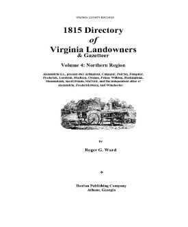
1815 DIRECTORY OF VIRGINIA LANDOWNERS & GAZETTEER, vol. 4 Northern Region (Includes the counties and cities of Alexandria (i.e., present-day Arlington), Culpeper, Fairfax, Fauquier, Frederick, Loudoun, Madison, Orange, Prince William, Rockingham, Shenandoah, Spotsylvania, Stafford, and the independent cities of Alexandria, Fredericksburg, and Winchester ) abstracted by Roger G. Ward. 1997, vi, 220 pages, indices, maps.
In 1782 the General Assembly of Virginia enacted new tax laws which created within each county an enumeration of land and certain personal property. These early land tax laws required a tax commissioner in each district of a county to record a list of the names of persons owning land or town lots, the quantity of land owned and its value, and the amount of tax owed. By 1813, a brief geographic description (usually citing an adjacent stream, road, or other landmark) was required; in 1814, the distance and direction from the courthouse for each parcel was also added to the tax rolls.
The present work is an alphabetical listing of all 1815 landowners found in each county, as well as the accompanying description of the location of the said property. We have not included the number of acres, taxes assessed, or any transactions between landowners which may have been noted on the tax rolls; also, in many cases the geographic location was provided as "adjacent to John Smith", etc. and, while useful many times to a genealogist, was considered to be beyond the objectives of this project. The reader is encouraged to consider the information here-in as an "outline" of early landowners in Virginia rather than a "text" due to the year-to-year variation in information provided to the clerk (or recorded by the clerk), omissions, lack of "identifiers" to determine if "same name" was also "same person" within a district or across districts, marginal quality/clarity (in a few cases) of the microfilm copy, and, not least, errors on the part of either the original clerks or the current author while transcribing.
Some of the approaches to utilizing the 1815 landowner information include:
  1. observe distinct clusters of the same surname within a county in order to clarify the common surnames such as "Smith", "Anderson", etc;
  2. identify non-resident landowners and their county (or state) of residence (these people often being former residents of the current county);
  3. determine neighbors with different surnames (often being relatives);
  4. use the 1815 information as a "bridge" from the 18th and 19th century deed/will books to the 17th and 18th century land grants/patents in the county;
  5. evaluate the 1810 to 1840 census information which generally grouped neighbors;
  6. substitute this information for missing deed/will books in the "burned" counties; and, clarify/enhance vague deed/will information in the counties with more complete records.
FORMAT OF PRESENTATION: Each entry is listed as: Surname, name, personal identifiers (if any); location/place-name of land; miles/direction from the 1815 courthouse. If multiple owners are listed for a property, the listing is duplicated under each of the owner's surnames (i.e "Smith and Brown" is also listed as "Brown, --see Smith"); when multiple owners share a common surname, the property is only listed once. When a landowner had land at more than one location/place-name, the miles/direction listing for each parcel is in the same sequence as the location listing (i.e. James RV, Slate CK; 12N, 5SW.). In the few cases where a landowner had "many" parcels, the miles/direction notation is attached to the location listing (i.e. Sandy RV- 5NE, Willow CK-7S, etc.)

Add to Cart

[Vdl4] $32.00    (paper version)


The above title is also available as a digital e-book in PDF format:
Add to Cart

[EVDL-4] $20.00     (electronic version)


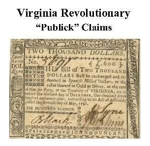
Fauquier Co. Revolutionary Public Claims transcribed by Janice L. Abercrombie and Richard Slatten.. 2005. 49 pages, 5 1/2X8 1/2.
For a full description of the Virginia Revolutionary Public Claims and a listing of available counties, see:
Revolutionary "Publick" Claims series


To view a digital copy (pdf) of the index to this book, visit Index-Fauq
(Close the pdf file with the left arrow to return to Iberian's catalog)
Add to Cart

[Pc22] $7.75     (printed version)


The above title is also available as a digital e-book in PDF format:

Add to Cart

[EPc22] $5.00     (electronic version)


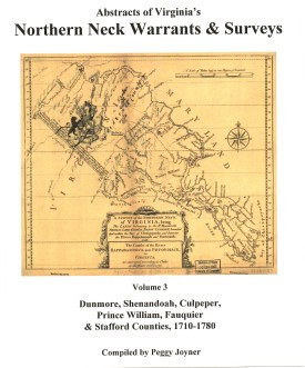
NORTHERN NECK (LAND) WARRANTS & SURVEYS, 1710-1780: DUNMORE, SHENANDOAH, CULPEPER, PRINCE WILLIAM, FAUQUIER & STAFFORD COUNTIES by Peggy Shomo Joyner. 1986, xx, 197 pp., map, illust. Published as the third volume in a series of Northern Neck Warrants & Surveys, this collection has become a standard reference work for researchers in the period of colonial Virginia history for this area.
Contents: Dunmore (pp. 1-26); Shenandoah (pp. 27-40); Culpeper (pp.41-88); Prince William (pp.89-135); Fauquier (pp.137-144); Stafford (pp.145-174); George Washington surveys (pp.175-176); index.

The Northern Neck Proprietary, also called the Fairfax Proprietary, or Fairfax Grant, was a land grant first created by the exiled English King Charles II in 1649 and encompassing all the lands bounded by the Potomac and Rappahannock Rivers in colonial Virginia. This constituted up to 5,200,000 acres of Virginia's Northern Neck and a vast area northwest of it.

The grant became actual in 1660 when Charles was restored to the English throne. By 1719, these lands had been inherited by Thomas Fairfax, 6th Lord Fairfax of Cameron (1693-1781). By that time the question of the boundaries of the designated lands had also become highly contentious. It was decided in 1746 that a line between the sources of the North Branch of the Potomac and the Rappahannock River (the "Fairfax Line") would constitute the western limit of Lord Fairfax's lands. The early 17th century decade was witnessing a wave of pioneer settlement throughout the region.

To obtain land a person purchased a warrant from the proprietor's agent specifying the precise location of the desired land. The warrant was then given to a surveyor, who surveyed the land. The plat, warrant, and any related papers were returned to the proprietor's office, and if the title was clear, a grant was recorded and then issued. At any point after the warrant was purchased the land could be assigned (sold) to another person, and years could elapse between the purchase of the warrant and the issuance of a grant.

The volume is arranged first by county, then alphabetic by grantee. Please note: The index provided at the end of the volume contains only those persons whose reference occurs outside the alphabetic listing in the volume. It is NOT a complete index of names or places.

Add to Cart

[NNW3] $27.00     (printed version)


The above title is also available as a digital e-book in PDF format:
Add to Cart

[ENNW3] $20.00     electronic version


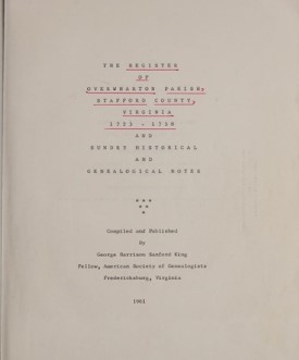
THE REGISTER OF OVERWHARTON PARISH, STAFFORD COUNTY, VIRGINIA 1723-1758 AND SUNDRY HISTORICAL AND GENEALOGICAL NOTES
by George Harrison Sanford King, xii, 1961. AVAILABLE IN ELECTRONIC (PDF) FORMAT ONLY

The county and parish take their names from the corresponding ones in England. Stafford county once extended up to the Blue Ridge Mountain. In the year 1730, Prince William county was formed from the "heads of King George and Stafford." Overwharton parish was also coextensive with Stafford before Prince William was divided and Hamilton parish taken off. In the same year,--1730,--Overwharton parish was divided and Hamilton parish taken off. Overwharton covered the narrow county of Stafford, and Hamilton the large county of Prince William before Fauquier, Fairfax, and Loudoun were taken away. Stafford, in its original dimensions, first appears as a county in 1666 when it was created from Westmoreland County. When it was erected into a parish is not known,--but most probably about the same time. Its division in 1730 is the first mention of it. The Rev. Robert Rose in his account book mentions the Rev. Alexander Scott as a minister in it in 1727

The Register of Overwharton Parish, Stafford County,.... was an update to the original 1899 publication of William F. Boogher (also available on this page [below]). It includes Births, Baptism, Marriage and Death records as recorded in their original order along with a supplemental index.

The Overwharton Register is arranged alphabetically by surnames in chronological order and these names are not carried into the general index.

To view a digital copy of the general index to this book, visit Index-Ovwp
(Close the pdf file with the left arrow to return to Iberian's catalog)
Add to Cart

[EOVWP] $18.00     (electronic version only)


OVERWHARTON PARISH, VIRGINIA REGISTER, 1720 TO 1760
by Wm. F. Boogher, 1899, xiii, 195 pages AVAILABLE IN ELECTRONIC (PDF) FORMAT ONLY

Overwharton Parish was formed in 1680 as the upper parish or Stafford Parish. The parish was co-extensive with Stafford County, covering a part of what was once Washington Parish, extending about eighty miles along the Potomac, in breadth about four and twenty miles, embracing within its territory what is now Prince William, Loudoun, Fairfax, Alexandria Counties and a part of Fauquier until 1730, when Prince William County was taken from Stafford, and Hamilton Parish was erected, succeeding Overwharton as the frontier parish. Of the early history of Overwharton Parish and its rectors, but little is known.

The entries in the parish register consist of births, marriages, and deaths and are arranged in one continuous alphabetical sequence. The marriage records take up nearly half of the register and provide the names of the bride and groom and the date of the marriage; the birth records include the name of the newborn, date of birth, and the names of parents; and the death records give the decedent by name and date of death. In all, more than 6,000 early inhabitants of Stafford County, Virginia are preserved in this valuable resource.

Add to Cart

[EOVRP] $15.00     (electronic version only)


For more records pertaining to FAUQUIER COUNTY, VIRGINIA see also:


Please see our HELP PAGE for mail-order instructions, wholesaler policies and other contact information.

|| Virginia/W.Va. || General Reference || Military Records ||
|| Other States || E-Books || New Titles
|| Home Page || E-Books ||

Copyright © 2026 Iberian Publishing Company