 Accomack Co. Revolutionary Public Claims
transcribed by Janice L. Abercrombie and Richard Slatten.. 2005. 8 pages, 5 1/2X8 1/2.
Accomack Co. Revolutionary Public Claims
transcribed by Janice L. Abercrombie and Richard Slatten.. 2005. 8 pages, 5 1/2X8 1/2.
For a full description of the Virginia Revolutionary Public Claims and a listing of available counties, see:
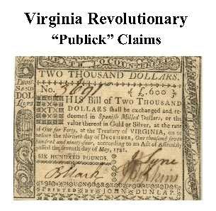
Revolutionary "Publick" Claims series
To view a digital copy (pdf) of the index to this book, visit Index-Accomack
(Close the pdf file with the left arrow to return to Iberian's catalog)
[Pc01] $6.00 (paper version)
The above title is also available as a digital e-book in PDF format:
[EPc01] $3.60 (electronic version)
For other records pertaining to ACCOMACK COUNTY, VIRGINIA see:
Index to the 1810 Virginia Census
Chart on the Formation of Virginia Counties
Atlas of County Boundary Changes in Virginia, 1634-1895


Please see our HELP PAGE for mail-order instructions, wholesaler policies and other contact information.


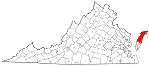 "Accawmack" County was one of the original eight shires created in 1634. In fact, it had begun to function as a separate political entity as early as January, 1632/33 Its Indian name meant "across-the-water-place". The Assembly changed its name to Northampton in March 1642/3. Accomack County was created in 1662 from the upper part of Northampton County and began to function as a county in its own right in April 1663. Between 1670 and 1674 Accomack and Northampton were reunited politically. The boundaries have not changed since its formation. The eastern and western boundaries are the Atlantic Ocean and Chesapeake Bay, respectively; its southern line adjoins Northampton and was defined in 1688. On the north it abuts the Maryland state line.

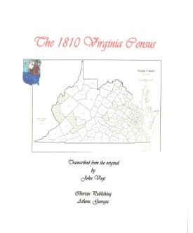 ACCOMACK CO., VA 1810 CENSUS transcribed by John Vogt. 2013, 10 1/2 x 8 1/2, x, 53 pages, illustrations, map, full name index. This is the first surviving
census for Bath, since both the 1790 and 1800 censuses have been lost. The transcription is in the order in which the enumerator took his census. Thus, neighbors appear together and this will assist the
genealogist. Accomack was a rich agricultural area consisting of the northern portion of the peninsula east of the chesapeake Bay. It had an early settlement and a rich history. It is also noted for the large number of free African-Americans resident there in the beginning of the nineteenth century
ACCOMACK CO., VA 1810 CENSUS transcribed by John Vogt. 2013, 10 1/2 x 8 1/2, x, 53 pages, illustrations, map, full name index. This is the first surviving
census for Bath, since both the 1790 and 1800 censuses have been lost. The transcription is in the order in which the enumerator took his census. Thus, neighbors appear together and this will assist the
genealogist. Accomack was a rich agricultural area consisting of the northern portion of the peninsula east of the chesapeake Bay. It had an early settlement and a rich history. It is also noted for the large number of free African-Americans resident there in the beginning of the nineteenth century Accomack Co. 1815 Directory of Landowners
by Roger G. Ward. 2005. 52 pages, map, 5 1/2X8 1/2.
Accomack Co. 1815 Directory of Landowners
by Roger G. Ward. 2005. 52 pages, map, 5 1/2X8 1/2.